MyTopo
Camp Creek South Dakota US Topo Map
Couldn't load pickup availability
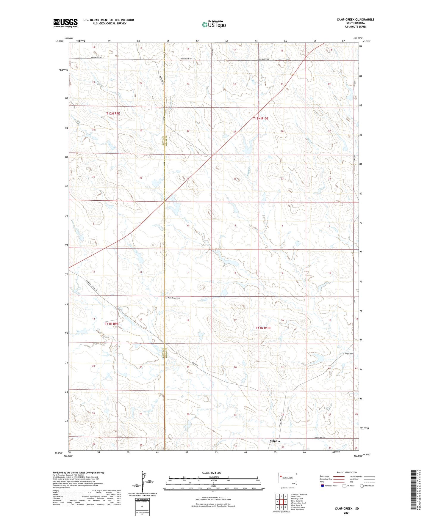
2021 topographic map quadrangle Camp Creek in the state of South Dakota. Scale: 1:24000. Based on the newly updated USGS 7.5' US Topo map series, this map is in the following counties: Meade, Butte. The map contains contour data, water features, and other items you are used to seeing on USGS maps, but also has updated roads and other features. This is the next generation of topographic maps. Printed on high-quality waterproof paper with UV fade-resistant inks.
Quads adjacent to this one:
West: Owl Butte NE
Northwest: Tomato Can Buttes
North: Mud Creek
Northeast: Beverly Creek
East: Frozen Man Creek
Southeast: Bull Run Creek
South: Table Top Butte
Southwest: Owl Butte SE
This map covers the same area as the classic USGS quad with code o44102h8.
Contains the following named places: Camp Creek, Christ Orwick Dam, Mud Butte School, Plum Creek, Plum Draw Cemetery, Saint Josephs Church, Sulphur, Township of Cedar, Township of Sulpher, William Patterson Dam