MyTopo
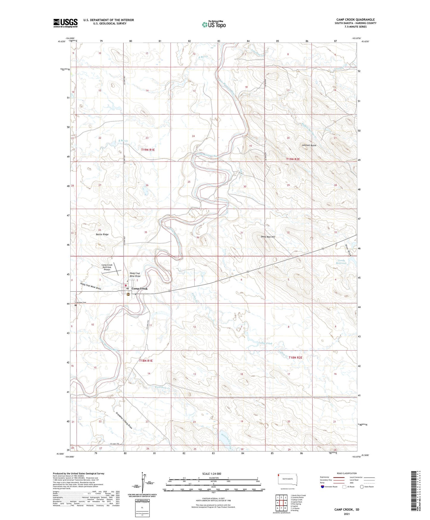
Camp Crook South Dakota US Topo Map
Couldn't load pickup availability
Also explore the Camp Crook Forest Service Topo of this same quad for updated USFS data
2021 topographic map quadrangle Camp Crook in the state of South Dakota. Scale: 1:24000. Based on the newly updated USGS 7.5' US Topo map series, this map is in the following counties: Harding. The map contains contour data, water features, and other items you are used to seeing on USGS maps, but also has updated roads and other features. This is the next generation of topographic maps. Printed on high-quality waterproof paper with UV fade-resistant inks.
Quads adjacent to this one:
West: Capitol Rock
Northwest: North Slick Creek
North: Caroline Butte
Northeast: Gallup Creek
East: Pine Spring
Southeast: Harding
South: J K Butte
Southwest: Capitol
This map covers the same area as the classic USGS quad with code o45103e8.
Contains the following named places: Antelope Creek, Ash Creek, Battle Ridge, Buffalo Springs Creek, Camp Crook, Camp Crook Community Fire Department, Camp Crook Elementary School, Camp Crook Municipal Airport, Camp Crook Post Office, Catron Irrigation Dam, Catron Ranch Airstrip, Cundy Reservoir, Dead Man Hill, Fairview Cemetery, Grandma Schang Draw, Harding County Ambulance Service, Hoag Coal Mine Draw, Johnson Butte, K Bar Creek, Mosely Ranch, Pine Draw, Sagebrush Dam, Town of Camp Crook, Valley Creek, Waterhole Creek