MyTopo
Armour South Dakota US Topo Map
Couldn't load pickup availability
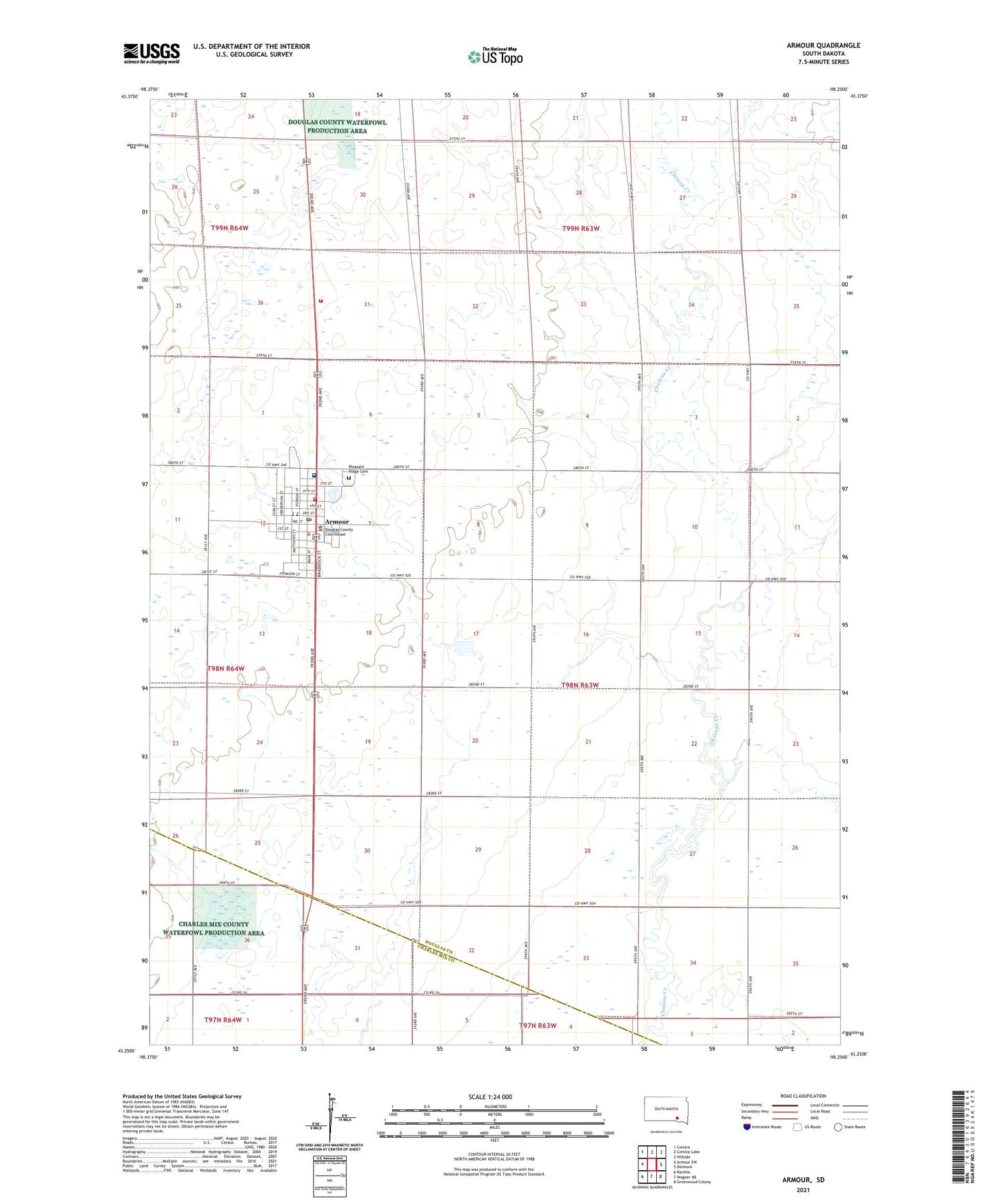
2021 topographic map quadrangle Armour in the state of South Dakota. Scale: 1:24000. Based on the newly updated USGS 7.5' US Topo map series, this map is in the following counties: Douglas, Charles Mix. The map contains contour data, water features, and other items you are used to seeing on USGS maps, but also has updated roads and other features. This is the next generation of topographic maps. Printed on high-quality waterproof paper with UV fade-resistant inks.
Quads adjacent to this one:
West: Armour SW
Northwest: Corsica
North: Corsica Lake
Northeast: Hillside
East: Delmont
Southeast: Greenwood Colony
South: Wagner NE
Southwest: Ravinia
This map covers the same area as the classic USGS quad with code o43098c3.
Contains the following named places: Armour, Armour City Hall, Armour Elementary School, Armour Fire Department, Armour High School, Armour Landing Strip, Armour Middle School, Armour Police Department, Armour Post Office, Armour Public Library, Armour Rural Fire Protection District, Baird School, City of Armour, Claybaugh School, Douglas County Ambulance Service Armour, Douglas County Courthouse, Douglas County Memorial Hospital, Douglas County Sheriff's Office, Evans School, Huston, Huston School, Pleasant Ridge Cemetery, Sunshine School, Township of Independence, ZIP Code: 57313