MyTopo
Corsica Lake South Dakota US Topo Map
Couldn't load pickup availability
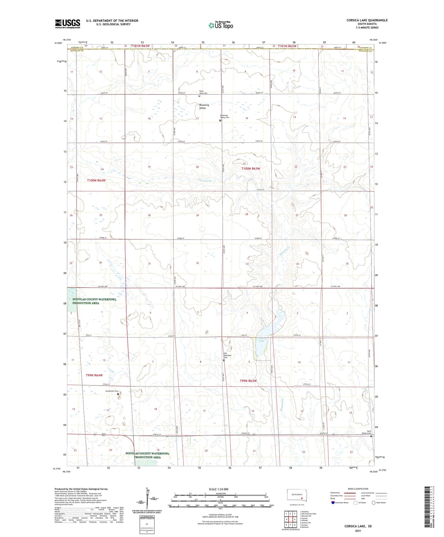
2021 topographic map quadrangle Corsica Lake in the state of South Dakota. Scale: 1:24000. Based on the newly updated USGS 7.5' US Topo map series, this map is in the following counties: Douglas, Davison, Aurora. The map contains contour data, water features, and other items you are used to seeing on USGS maps, but also has updated roads and other features. This is the next generation of topographic maps. Printed on high-quality waterproof paper with UV fade-resistant inks.
Quads adjacent to this one:
West: Corsica
Northwest: Stickney
North: Old Stickney Lake
Northeast: Mitchell SW
East: Hillside
Southeast: Delmont
South: Armour
Southwest: Armour SW
Contains the following named places: Beulah Post Office, Beulah School, Blooming Valley, Blooming Valley Cemetery, Corsica City Park, Corsica Lake, Corsica Lake Dam, Coyote Center School, Douglas City, Douglas County, Ebenezer, Ebenezer School, Fineran School, Gardeman School, Grandview, Grandview Cemetery, Grandview School, Old Ebenezer Cemetery, Ruff School, Saint John Cemetery, Saint John Church, Saint Peters Cemetery, Saint Peters Church, Shrank School, Storm School, Township of Garfield, Township of Valley, Valley, Wertz School