MyTopo
Hillside South Dakota US Topo Map
Couldn't load pickup availability
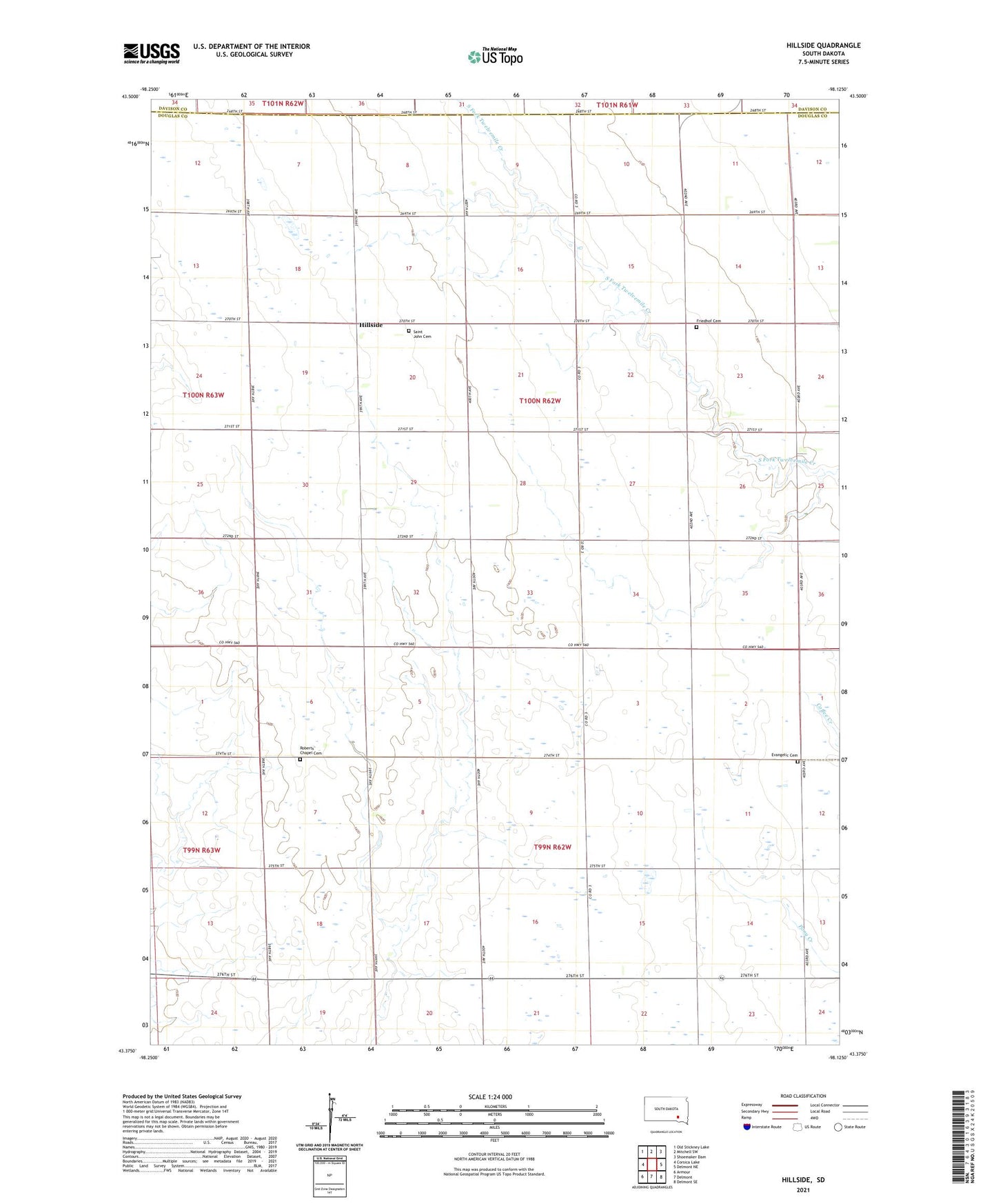
2021 topographic map quadrangle Hillside in the state of South Dakota. Scale: 1:24000. Based on the newly updated USGS 7.5' US Topo map series, this map is in the following counties: Douglas, Davison. The map contains contour data, water features, and other items you are used to seeing on USGS maps, but also has updated roads and other features. This is the next generation of topographic maps. Printed on high-quality waterproof paper with UV fade-resistant inks.
Quads adjacent to this one:
West: Corsica Lake
Northwest: Old Stickney Lake
North: Mitchell SW
Northeast: Shoemaker Dam
East: Delmont NE
Southeast: Delmont SE
South: Delmont
Southwest: Armour
This map covers the same area as the classic USGS quad with code o43098d2.
Contains the following named places: Evangelic Cemetery, Flensburg Post Office, Friedhof Cemetery, Gerlach School, Hillside, Hillside School, Immanuel Church, Plainview, Roberts Chapel Cemetery, Rocky Ridge School, Saint John Cemetery, Saint John Church, Scott Post Office, Struck School, Thury School, Township of Berlin, Township of Lincoln, Township of Washington, Washington Number 1 School, Wenzel School