MyTopo
Delmont South Dakota US Topo Map
Couldn't load pickup availability
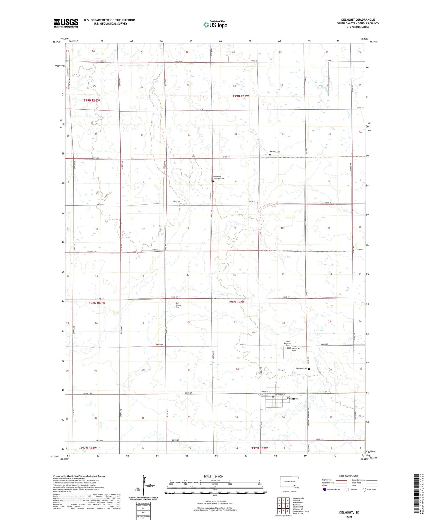
2021 topographic map quadrangle Delmont in the state of South Dakota. Scale: 1:24000. Based on the newly updated USGS 7.5' US Topo map series, this map is in the following counties: Douglas. The map contains contour data, water features, and other items you are used to seeing on USGS maps, but also has updated roads and other features. This is the next generation of topographic maps. Printed on high-quality waterproof paper with UV fade-resistant inks.
Quads adjacent to this one:
West: Armour
Northwest: Corsica Lake
North: Hillside
Northeast: Delmont NE
East: Delmont SE
Southeast: Oak Hollow
South: Greenwood Colony
Southwest: Wagner NE
This map covers the same area as the classic USGS quad with code o43098c2.
Contains the following named places: Baier School, Brenner School, City of Delmont, Delmont, Delmont Cemetery, Delmont Community Center, Delmont Police Department, Delmont Post Office, Delmont Volunteer Fire Department, Emmanuel Lutheran Cemetery, Hope Lutheran Cemetery, Lindbergh School, Maitland, Neusatz Cemetery, Old Missouri Cemetery, Opera Block Library, Schroeder School, Serr School, Township of Belmont, Township of Huston, Zion Lutheran Cemetery