MyTopo
Eagle South Dakota US Topo Map
Couldn't load pickup availability
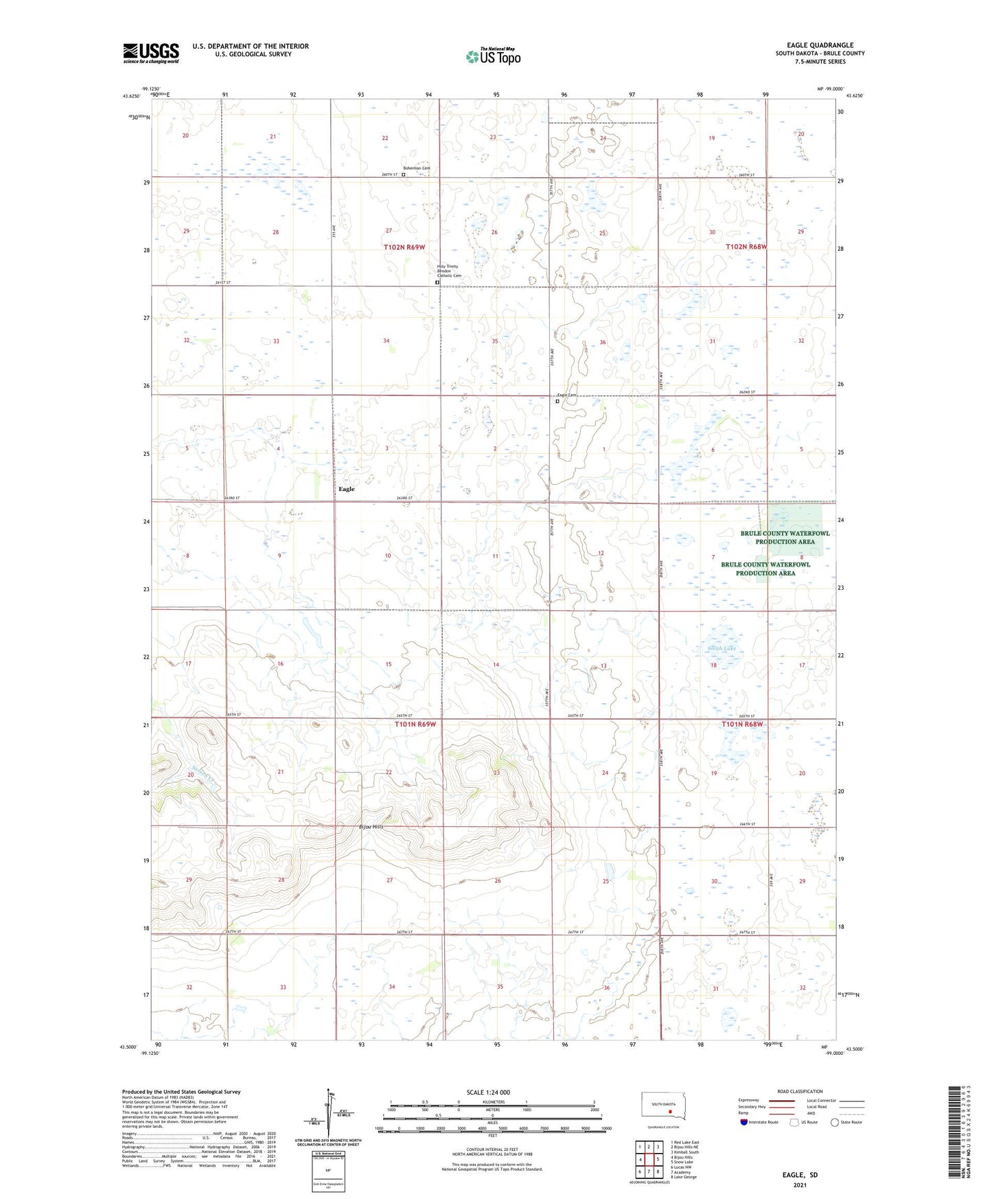
2021 topographic map quadrangle Eagle in the state of South Dakota. Scale: 1:24000. Based on the newly updated USGS 7.5' US Topo map series, this map is in the following counties: Brule. The map contains contour data, water features, and other items you are used to seeing on USGS maps, but also has updated roads and other features. This is the next generation of topographic maps. Printed on high-quality waterproof paper with UV fade-resistant inks.
Quads adjacent to this one:
West: Bijou Hills
Northwest: Red Lake East
North: Bijou Hills NE
Northeast: Kimball South
East: Snow Lake
Southeast: Lake George
South: Academy
Southwest: Lucas NW
This map covers the same area as the classic USGS quad with code o43099e1.
Contains the following named places: Bendon, Blessed Trinity Church, Bohemian Cemetery, Chain Lakes State Public Shooting Area, Eagle, Eagle Cemetery, Holy Trinity Bendon Catholic Cemetery, Maresh School, Smith Lake, Township of Eagle