MyTopo
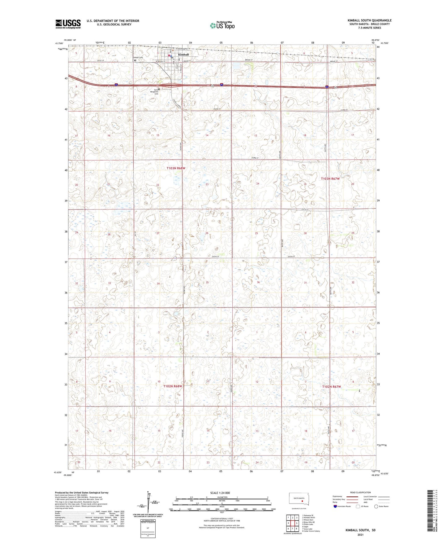
Kimball South South Dakota US Topo Map
Couldn't load pickup availability
2021 topographic map quadrangle Kimball South in the state of South Dakota. Scale: 1:24000. Based on the newly updated USGS 7.5' US Topo map series, this map is in the following counties: Brule. The map contains contour data, water features, and other items you are used to seeing on USGS maps, but also has updated roads and other features. This is the next generation of topographic maps. Printed on high-quality waterproof paper with UV fade-resistant inks.
Quads adjacent to this one:
West: Bijou Hills NE
Northwest: Pukwana SE
North: Kimball North
Northeast: Wilson Dam
East: Platte Lake
Southeast: Cedar Grove Colony
South: Snow Lake
Southwest: Eagle
This map covers the same area as the classic USGS quad with code o43098f8.
Contains the following named places: City of Kimball, Grass Ranch Colony, Grass Ranch Colony Census Designated Place, Grass Ranch Colony Elementary School, Grass Ranch Colony High School, Kimball, Kimball Cemetery, Kimball Centennial Library, Kimball City Office, Kimball Elementary School, Kimball Fire Department, Kimball High School, Kimball Junior High School, Kimball Police Department, Kimball Post Office, Kimball State Public Shooting Area, Kimball Volunteer Ambulance Service, Mulehead Point, Saint Margarets Cemetery, South Dakota Tractor Museum, Township of Highland, Township of Kimball