
MyTopo
Elm Creek Ranch South Dakota US Topo Map
Couldn't load pickup availability
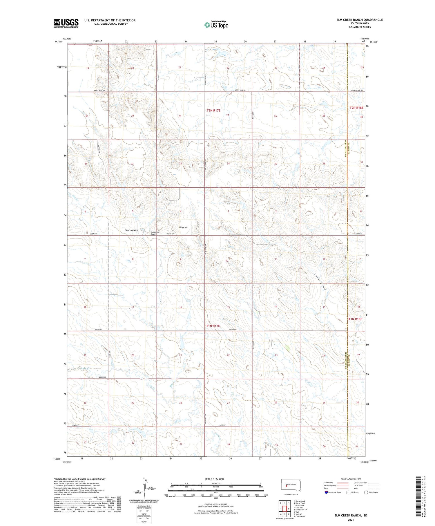
2021 topographic map quadrangle Elm Creek Ranch in the state of South Dakota. Scale: 1:24000. Based on the newly updated USGS 7.5' US Topo map series, this map is in the following counties: Pennington, Haakon. The map contains contour data, water features, and other items you are used to seeing on USGS maps, but also has updated roads and other features. This is the next generation of topographic maps. Printed on high-quality waterproof paper with UV fade-resistant inks.
Quads adjacent to this one:
West: Lake Hill
Northwest: Rainy Creek
North: Horse Tooth
Northeast: Grindstone
East: Grindstone SW
Southeast: Cottonwood
South: Wall NE
Southwest: Wall
Contains the following named places: Bliss Hill, Clark Landing Strip, Elm Creek, Elm Creek Ranch, George Kjerstad Dam, Hoffman Landing Strip, Hubbard Hill, Joe Papousek Dam, Konrad Kjerstad Dam, Leonard Kjerstad Number 2 Dam, Leonard Kjerstad Number 3 Dam, Sieler Dam, Theodore Kjerstad Dam, Tony Krebs Dam, Township of Lake Creek, Township of Peno, Unorganized Territory of Lake Creek, ZIP Code: 57775


