MyTopo
Horse Tooth South Dakota US Topo Map
Couldn't load pickup availability
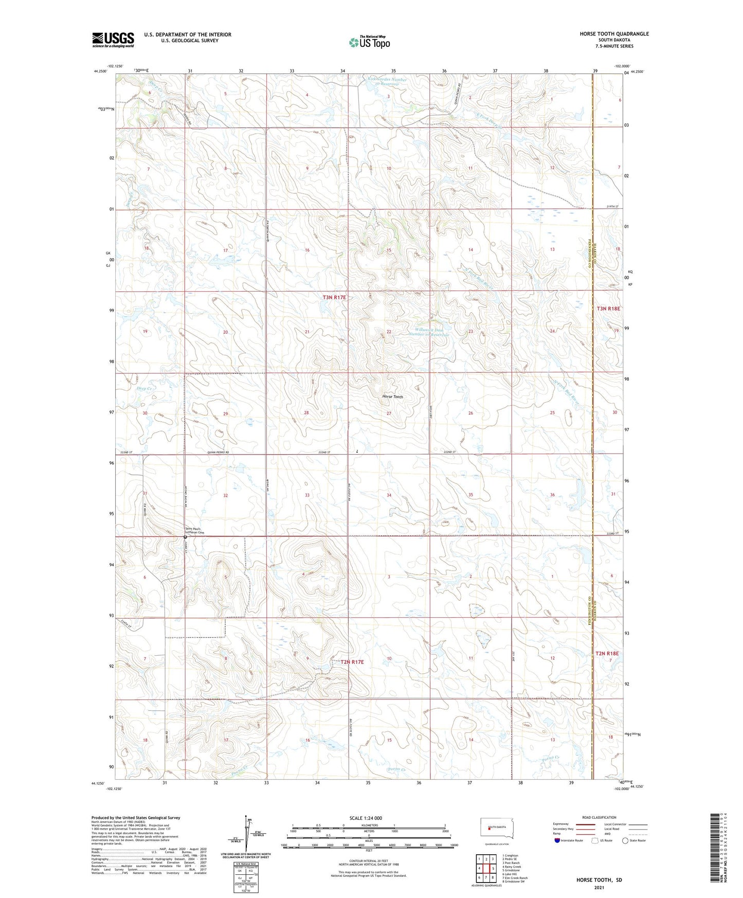
2021 topographic map quadrangle Horse Tooth in the state of South Dakota. Scale: 1:24000. Based on the newly updated USGS 7.5' US Topo map series, this map is in the following counties: Pennington, Haakon. The map contains contour data, water features, and other items you are used to seeing on USGS maps, but also has updated roads and other features. This is the next generation of topographic maps. Printed on high-quality waterproof paper with UV fade-resistant inks.
Quads adjacent to this one:
West: Rainy Creek
Northwest: Creighton
North: Pedro SE
Northeast: Post Ranch
East: Grindstone
Southeast: Grindstone SW
South: Elm Creek Ranch
Southwest: Lake Hill
This map covers the same area as the classic USGS quad with code o44102b1.
Contains the following named places: Big White Elementary School, Harold Severson Dam, Horse Tooth, Jerry Willuweit Dam, Kirk Cordes Dam, Kirk Cordes Number 10 Reservoir, Kirk Cordes Number 20 Reservoir, Kirk Cordes Number 40 Reservoir, Peno Basin Civic Center, Saint Paul's Lutheran Cemetery, Severson Ranch, Willuweit Dam Number 10 Reservoir