MyTopo
Rainy Creek South Dakota US Topo Map
Couldn't load pickup availability
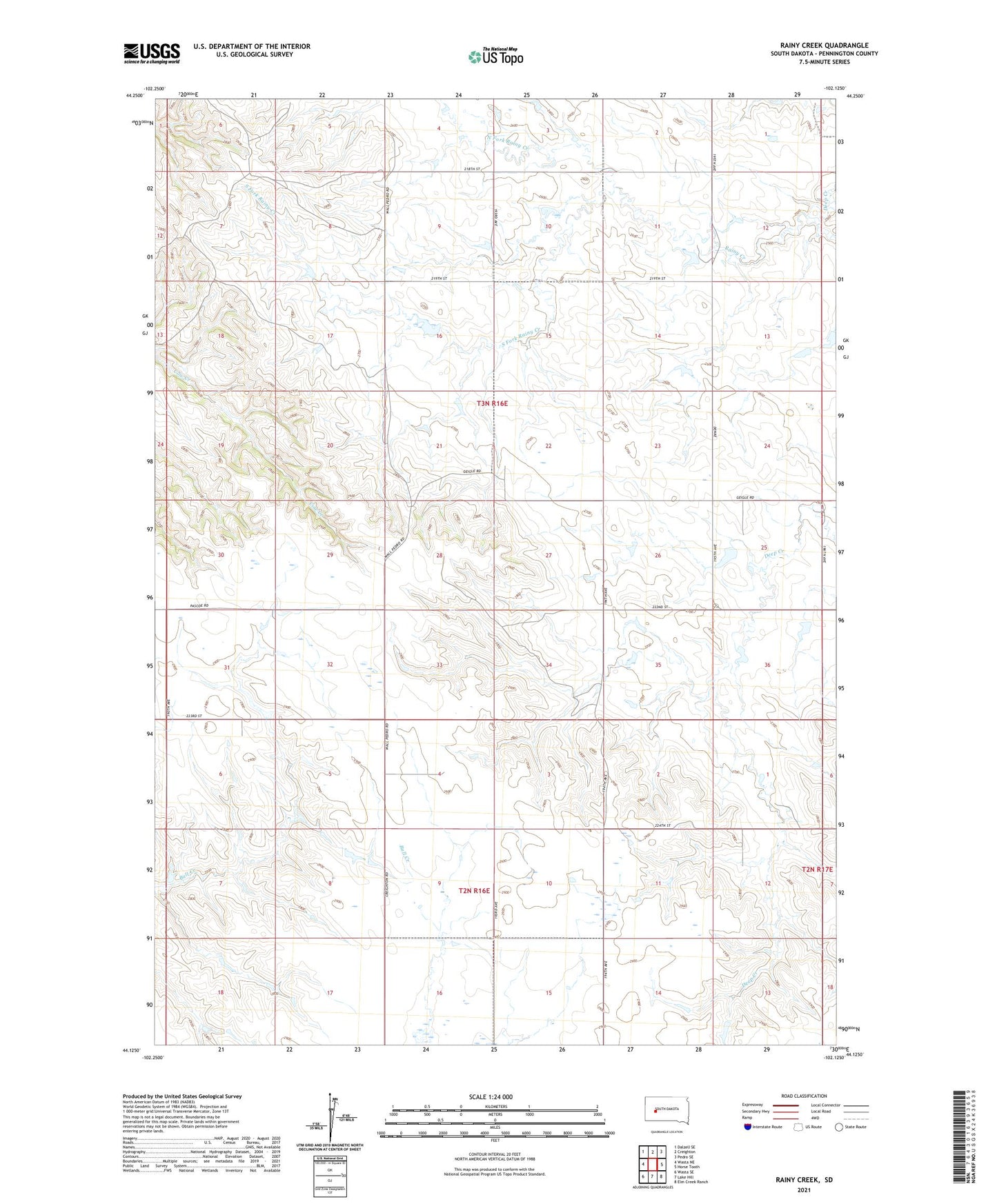
2021 topographic map quadrangle Rainy Creek in the state of South Dakota. Scale: 1:24000. Based on the newly updated USGS 7.5' US Topo map series, this map is in the following counties: Pennington. The map contains contour data, water features, and other items you are used to seeing on USGS maps, but also has updated roads and other features. This is the next generation of topographic maps. Printed on high-quality waterproof paper with UV fade-resistant inks.
Quads adjacent to this one:
West: Wasta NE
Northwest: Dalzell SE
North: Creighton
Northeast: Pedro SE
East: Horse Tooth
Southeast: Elm Creek Ranch
South: Lake Hill
Southwest: Wasta SE
This map covers the same area as the classic USGS quad with code o44102b2.
Contains the following named places: 109 Community Hall, Creighton Community Hall, Geigle Dam, Hoffman Dam, Lavon Shearer Dam, North Fork Rainy Creek, Rainy Creek, South Fork Rainy Creek, Township of Ash, Walt Hoffman Number 1 Dam, Willuwett Ranch