MyTopo
Grindstone South Dakota US Topo Map
Couldn't load pickup availability
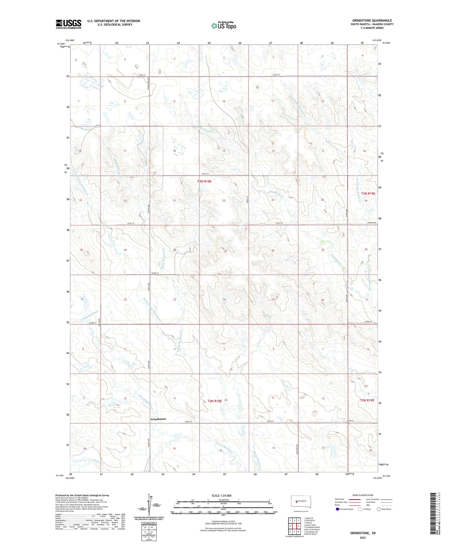
2021 topographic map quadrangle Grindstone in the state of South Dakota. Scale: 1:24000. Based on the newly updated USGS 7.5' US Topo map series, this map is in the following counties: Haakon. The map contains contour data, water features, and other items you are used to seeing on USGS maps, but also has updated roads and other features. This is the next generation of topographic maps. Printed on high-quality waterproof paper with UV fade-resistant inks.
Quads adjacent to this one:
West: Horse Tooth
Northwest: Pedro SE
North: Post Ranch
Northeast: Hilland
East: Grindstone Butte
Southeast: Bowen Ranch
South: Grindstone SW
Southwest: Elm Creek Ranch
This map covers the same area as the classic USGS quad with code o44101b8.
Contains the following named places: Dirty Womans Creek, Grindstone, Lincoln School, North Fork Deadmans Creek, Poeno Creek, Township of Lincoln, West Fork Dirty Womans Creek