
MyTopo
Fort Meade South Dakota US Topo Map
Couldn't load pickup availability
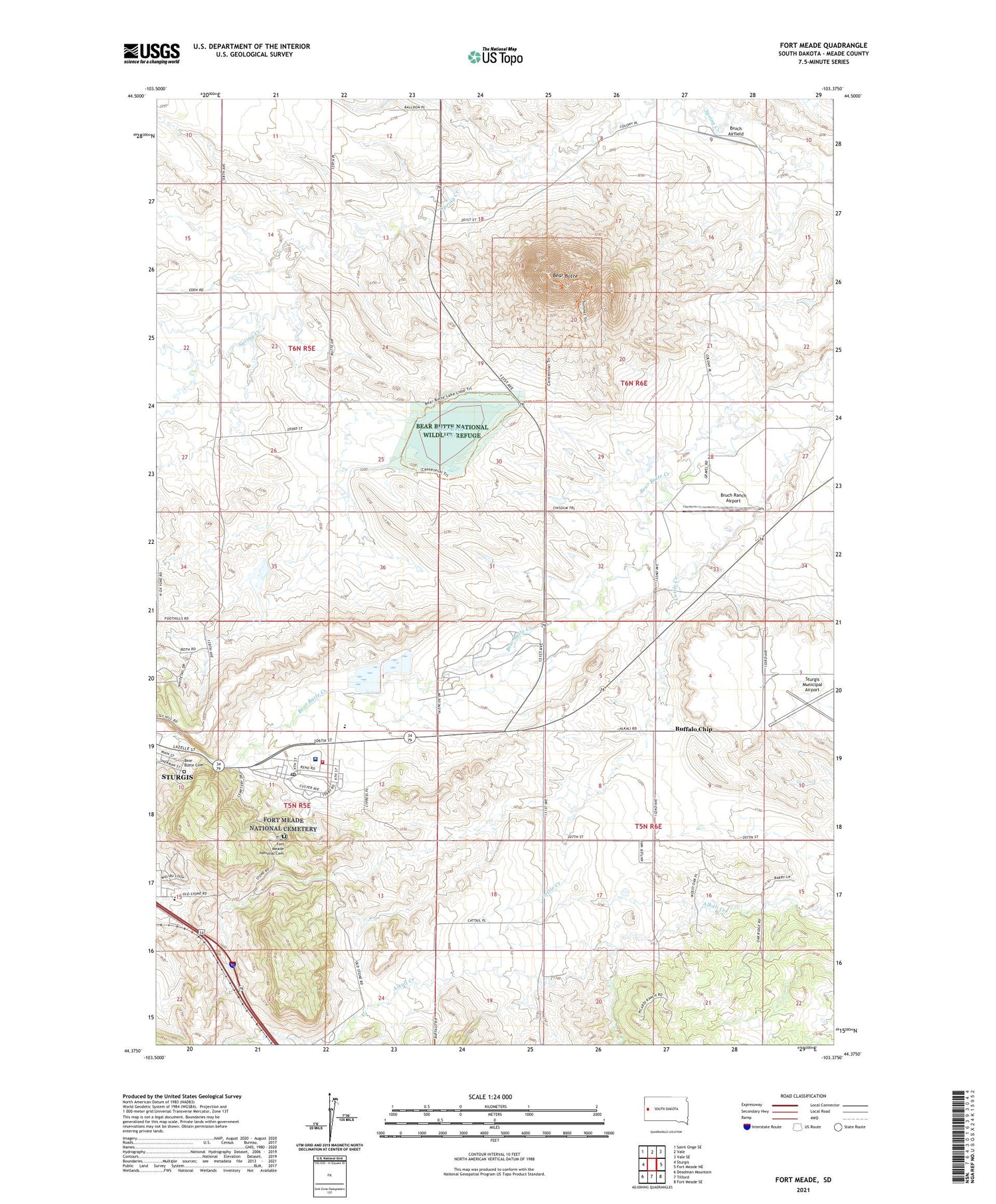
2021 topographic map quadrangle Fort Meade in the state of South Dakota. Scale: 1:24000. Based on the newly updated USGS 7.5' US Topo map series, this map is in the following counties: Meade. The map contains contour data, water features, and other items you are used to seeing on USGS maps, but also has updated roads and other features. This is the next generation of topographic maps. Printed on high-quality waterproof paper with UV fade-resistant inks.
Quads adjacent to this one:
West: Sturgis
Northwest: Saint Onge SE
North: Vale
Northeast: Vale SE
East: Fort Meade NE
Southeast: Fort Meade SE
South: Tilford
Southwest: Deadman Mountain
Contains the following named places: Alkali, Bear Butte, Bear Butte Cemetery, Bear Butte Lake, Bear Butte National Wildlife Refuge, Brown High School, Bruch Airfield, Buffalo Chip, Carpenter School, City of Sturgis, Eden Valley Airport, Fort Meade Fire Department, Fort Meade National Cemetery, Fort Meade Post Office, Hamm School, KBHB-AM (Sturgis), Spring Creek School, Sturgis Municipal Airport, Town of Buffalo Chip, Veterans Affairs Black Hills Health Care System Fort Meade Campus, Yahr Park, ZIP Code: 57741


