MyTopo
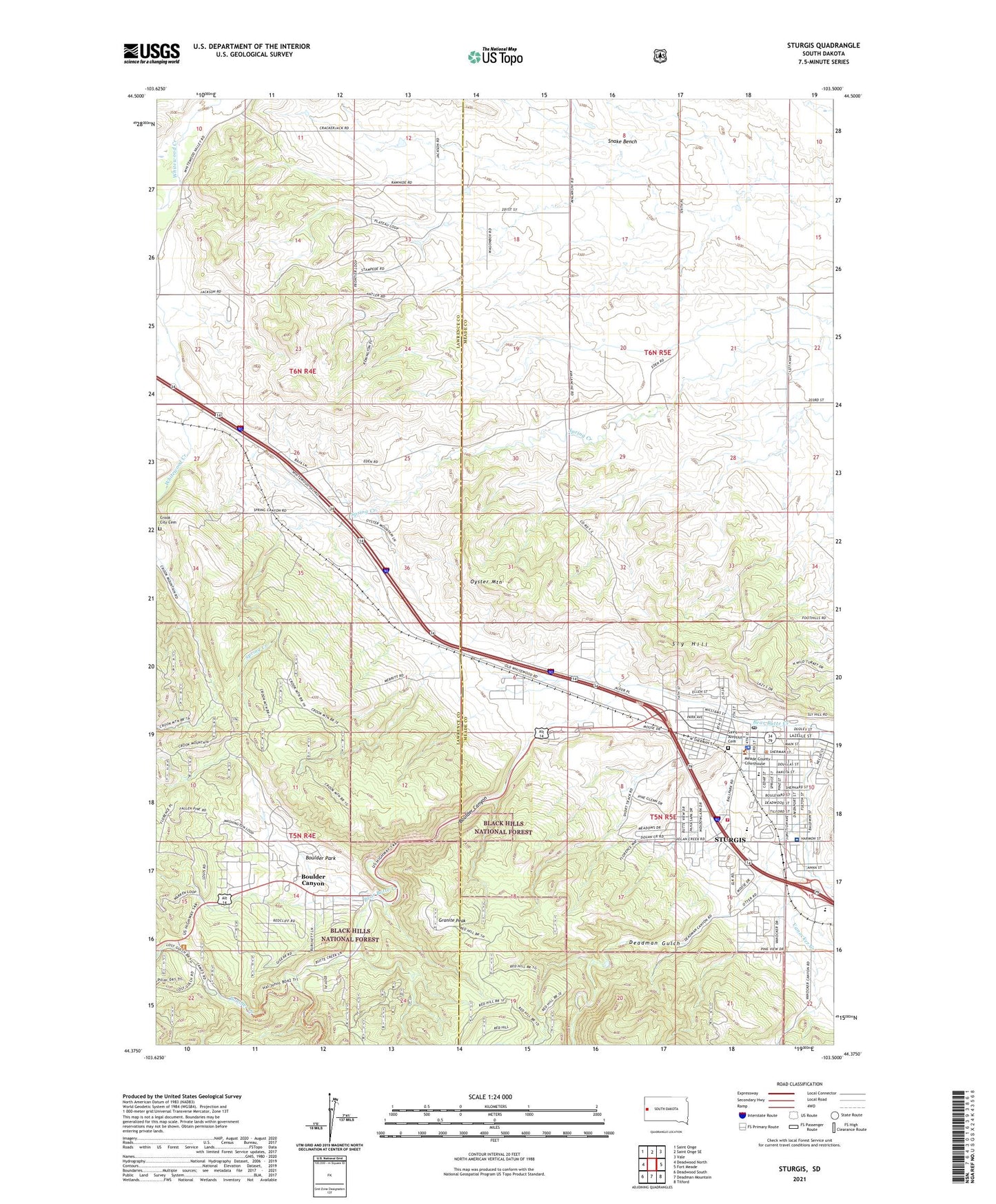
Sturgis South Dakota US Topo Map
Couldn't load pickup availability
Also explore the Sturgis Forest Service Topo of this same quad for updated USFS data
2021 topographic map quadrangle Sturgis in the state of South Dakota. Scale: 1:24000. Based on the newly updated USGS 7.5' US Topo map series, this map is in the following counties: Meade, Lawrence. The map contains contour data, water features, and other items you are used to seeing on USGS maps, but also has updated roads and other features. This is the next generation of topographic maps. Printed on high-quality waterproof paper with UV fade-resistant inks.
Quads adjacent to this one:
West: Deadwood North
Northwest: Saint Onge
North: Saint Onge SE
Northeast: Vale
East: Fort Meade
Southeast: Tilford
South: Deadman Mountain
Southwest: Deadwood South
This map covers the same area as the classic USGS quad with code o44103d5.
Contains the following named places: Boulder, Boulder Canyon, Boulder Canyon Census Designated Place, Boulder Creek, Boulder Park, Boulder Park School, Case School, Crook City Cemetery, Deadman Gulch, Eden School, Erskine School, Granite Peak, Meade County Courthouse, Meade County Jail, Meade County Sheriff's Office, Oyster Mountain, Saint Aloysius Cemetery, Sly Hill, Snake Bench, Sturgis, Sturgis City Hall, Sturgis Elementary School, Sturgis Fire and Emergency Services, Sturgis Motorcycle Museum and Hall of Fame, Sturgis Police Department, Sturgis Post Office, Sturgis Public Library, Sturgis Regional Hospital, Sturgis Sandstone Quarry, Vanocker Creek, Williams Junior High School