MyTopo
Tilford South Dakota US Topo Map
Couldn't load pickup availability
Also explore the Tilford Forest Service Topo of this same quad for updated USFS data
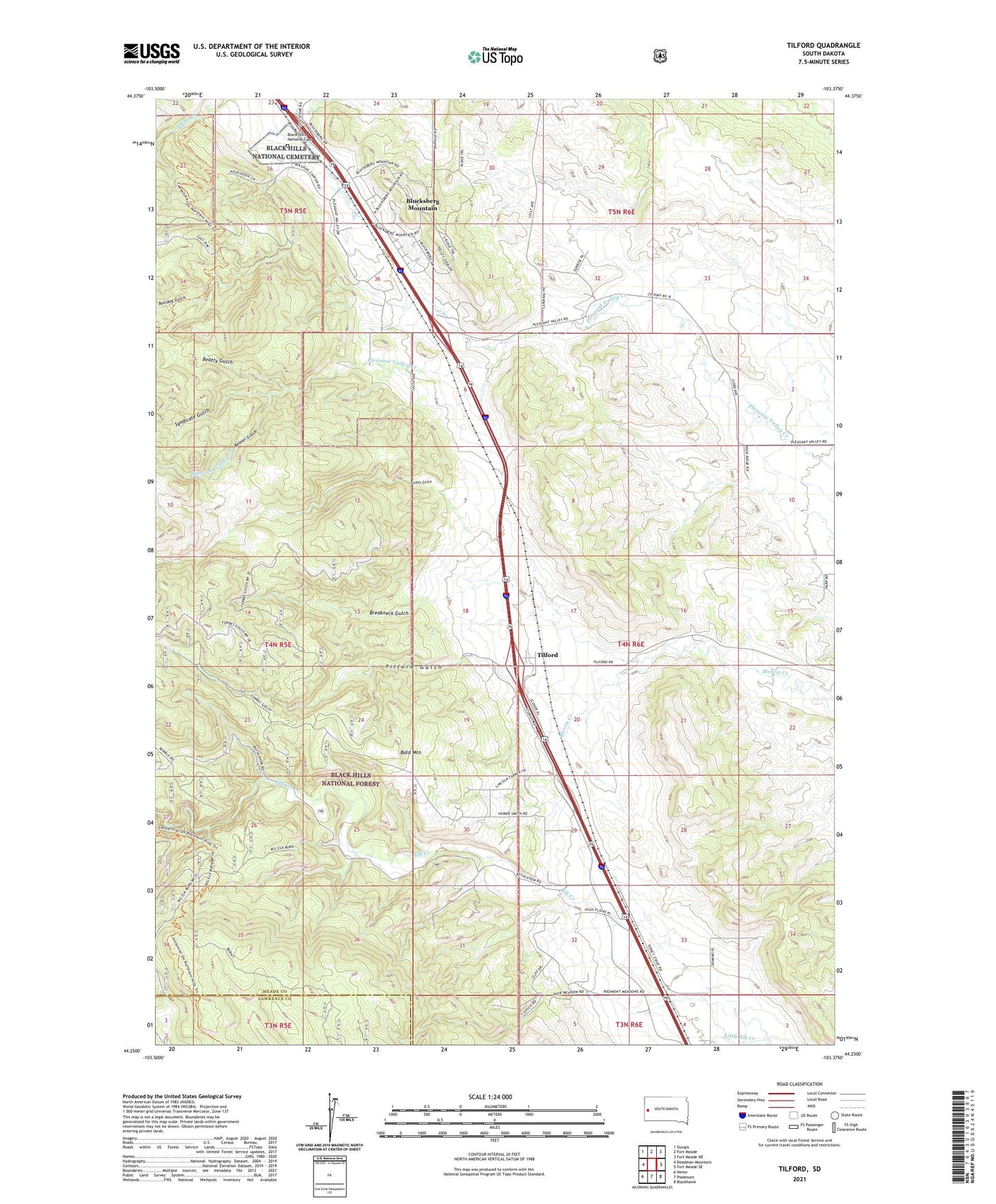
2021 topographic map quadrangle Tilford in the state of South Dakota. Scale: 1:24000. Based on the newly updated USGS 7.5' US Topo map series, this map is in the following counties: Meade, Lawrence. The map contains contour data, water features, and other items you are used to seeing on USGS maps, but also has updated roads and other features. This is the next generation of topographic maps. Printed on high-quality waterproof paper with UV fade-resistant inks.
Quads adjacent to this one:
West: Deadman Mountain
Northwest: Sturgis
North: Fort Meade
Northeast: Fort Meade NE
East: Fort Meade SE
Southeast: Blackhawk
South: Piedmont
Southwest: Nemo
This map covers the same area as the classic USGS quad with code o44103c4.
Contains the following named places: Bald Mountain, Beatty Gulch, Beaver Gulch, Beaver Siding, Black Hills National Cemetery, Blucksberg Mountain Census Designated Place, Breakneck Gulch, Bulldog Gulch, Calcite, Crystal Cave, Doyle, Forbes Gulch, Little Elk Creek, South Bend, South Dakota Highway Patrol - Tilford Port of Entry, Syndicate Gulch, Tilford, Tilford Gulch, Upper Pleasant Valley School