MyTopo
Deadman Mountain South Dakota US Topo Map
Couldn't load pickup availability
Also explore the Deadman Mountain Forest Service Topo of this same quad for updated USFS data
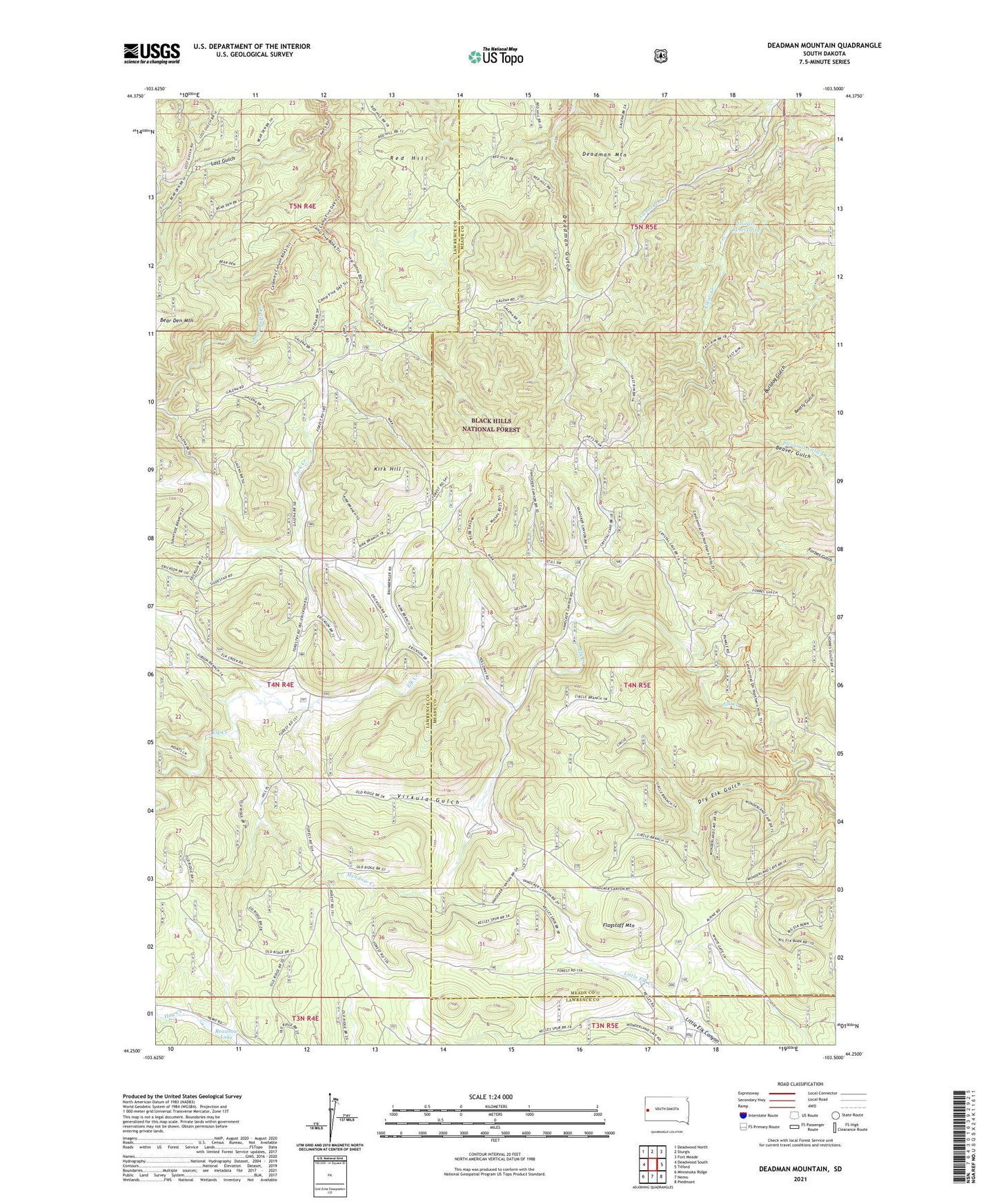
2021 topographic map quadrangle Deadman Mountain in the state of South Dakota. Scale: 1:24000. Based on the newly updated USGS 7.5' US Topo map series, this map is in the following counties: Meade, Lawrence. The map contains contour data, water features, and other items you are used to seeing on USGS maps, but also has updated roads and other features. This is the next generation of topographic maps. Printed on high-quality waterproof paper with UV fade-resistant inks.
Quads adjacent to this one:
West: Deadwood South
Northwest: Deadwood North
North: Sturgis
Northeast: Fort Meade
East: Tilford
Southeast: Piedmont
South: Nemo
Southwest: Minnesota Ridge
This map covers the same area as the classic USGS quad with code o44103c5.
Contains the following named places: Anthonys, Apex, Bear Butte, Bethlehem, Centennial Trail, Deadman Mountain, Dry Elk Gulch, Elk Creek, Flagstaff Mountain, Fort Meade Veterans Administration Watershed, Germania, Kirk Hill, KRCS-FM (Sturgis), Lost Gulch, Meadow Creek, Mowatt, Park Creek, Reausaw Lake, Reausew, Red Hill, Runkel, Sturgis Reservoirs, Two Bit Mine, Veteran Lookout Tower, Virkula Gulch