MyTopo
Storla South Dakota US Topo Map
Couldn't load pickup availability
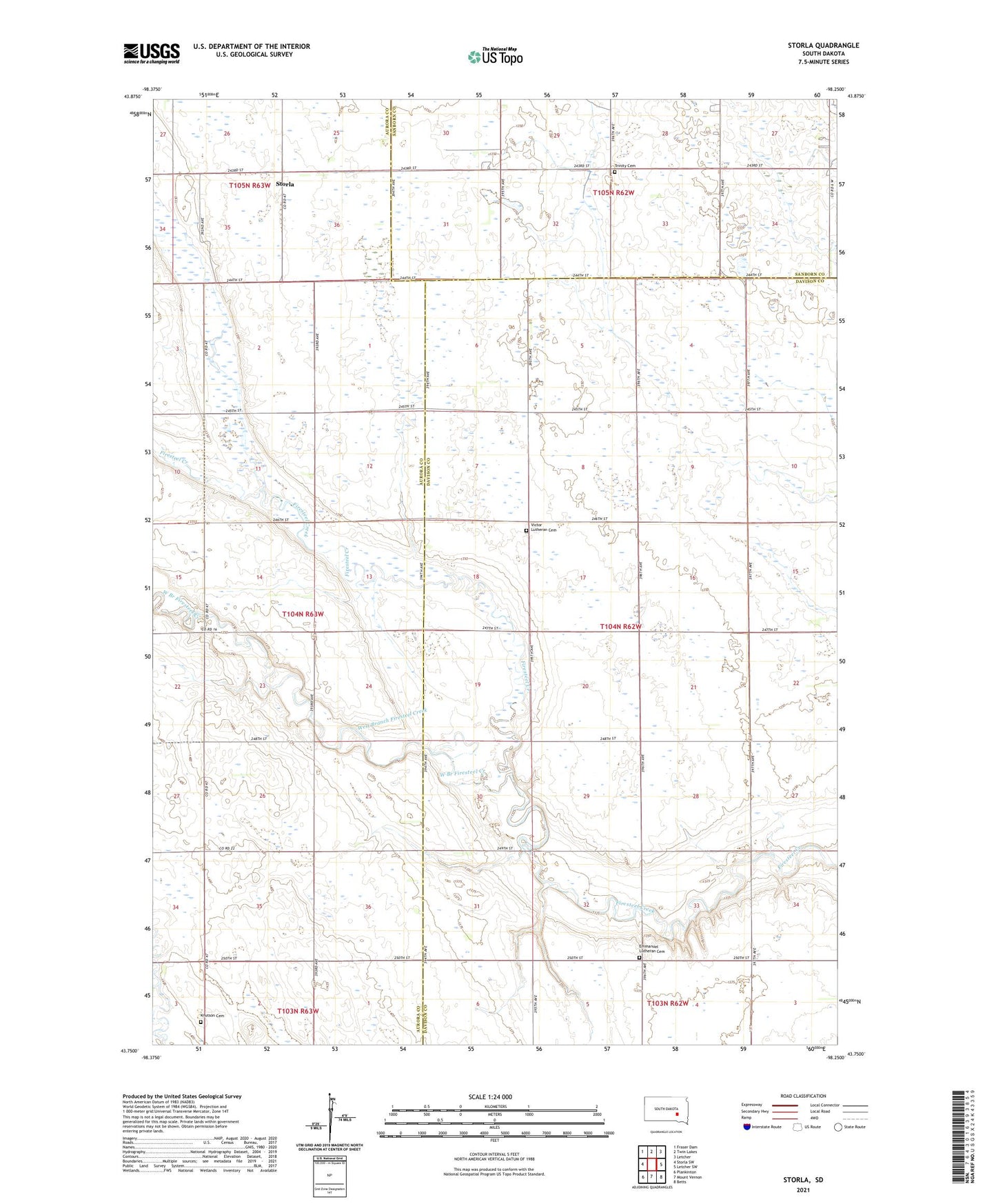
2021 topographic map quadrangle Storla in the state of South Dakota. Scale: 1:24000. Based on the newly updated USGS 7.5' US Topo map series, this map is in the following counties: Davison, Aurora, Sanborn. The map contains contour data, water features, and other items you are used to seeing on USGS maps, but also has updated roads and other features. This is the next generation of topographic maps. Printed on high-quality waterproof paper with UV fade-resistant inks.
Quads adjacent to this one:
West: Storla SW
Northwest: Fraser Dam
North: Twin Lakes
Northeast: Letcher
East: Letcher SW
Southeast: Betts
South: Mount Vernon
Southwest: Plankinton
This map covers the same area as the classic USGS quad with code o43098g3.
Contains the following named places: Blendon School, Emmanuel Lutheran Cemetery, Immanuel Church, Knutson Cemetery, Storla, Storla Census Designated Place, Township of Blendon, Trinity Cemetery, Trinity Church, Victor Church, Victor Lutheran Cemetery, West Branch Firesteel Creek