MyTopo
Wilmarth Lake South Dakota US Topo Map
Couldn't load pickup availability
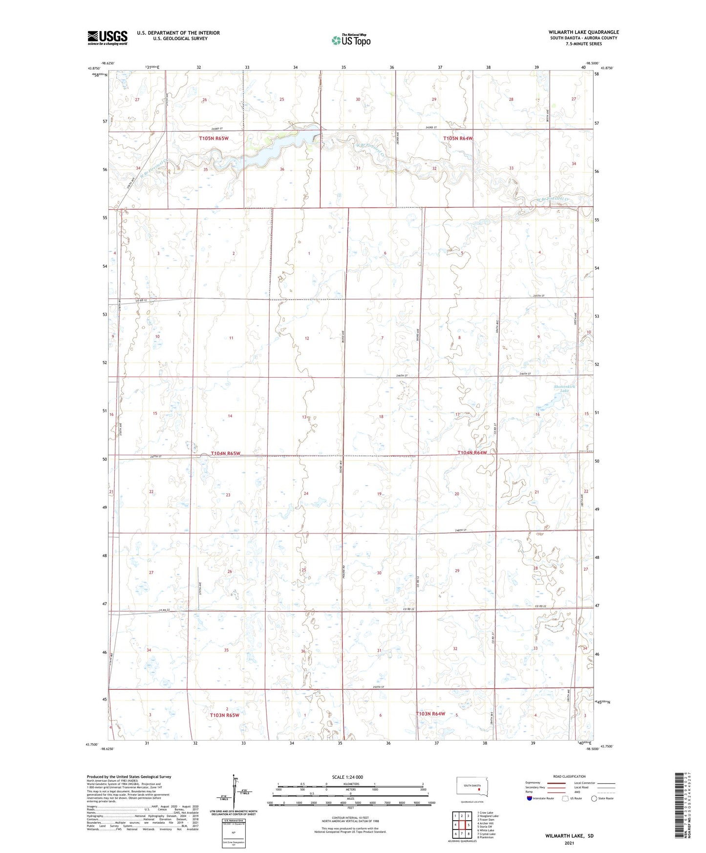
2021 topographic map quadrangle Wilmarth Lake in the state of South Dakota. Scale: 1:24000. Based on the newly updated USGS 7.5' US Topo map series, this map is in the following counties: Aurora. The map contains contour data, water features, and other items you are used to seeing on USGS maps, but also has updated roads and other features. This is the next generation of topographic maps. Printed on high-quality waterproof paper with UV fade-resistant inks.
Quads adjacent to this one:
West: Archer Hill
Northwest: Crow Lake
North: Hoagland Lake
Northeast: Fraser Dam
East: Storla SW
Southeast: Plankinton
South: Crystal Lake
Southwest: White Lake
This map covers the same area as the classic USGS quad with code k43098g5.
Contains the following named places: Cooper Townhall, Cruthoff School, Maher School, Monitor School, Phantom Lake, Shottenkirk Lake, Township of Cooper, Township of Firesteel, Turner School, Union School, Willow Bend School, Wilmarth Dam, Wilmarth Lake, Wilmarth Lake Game Production Area