MyTopo
Goodwill South Dakota US Topo Map
Couldn't load pickup availability
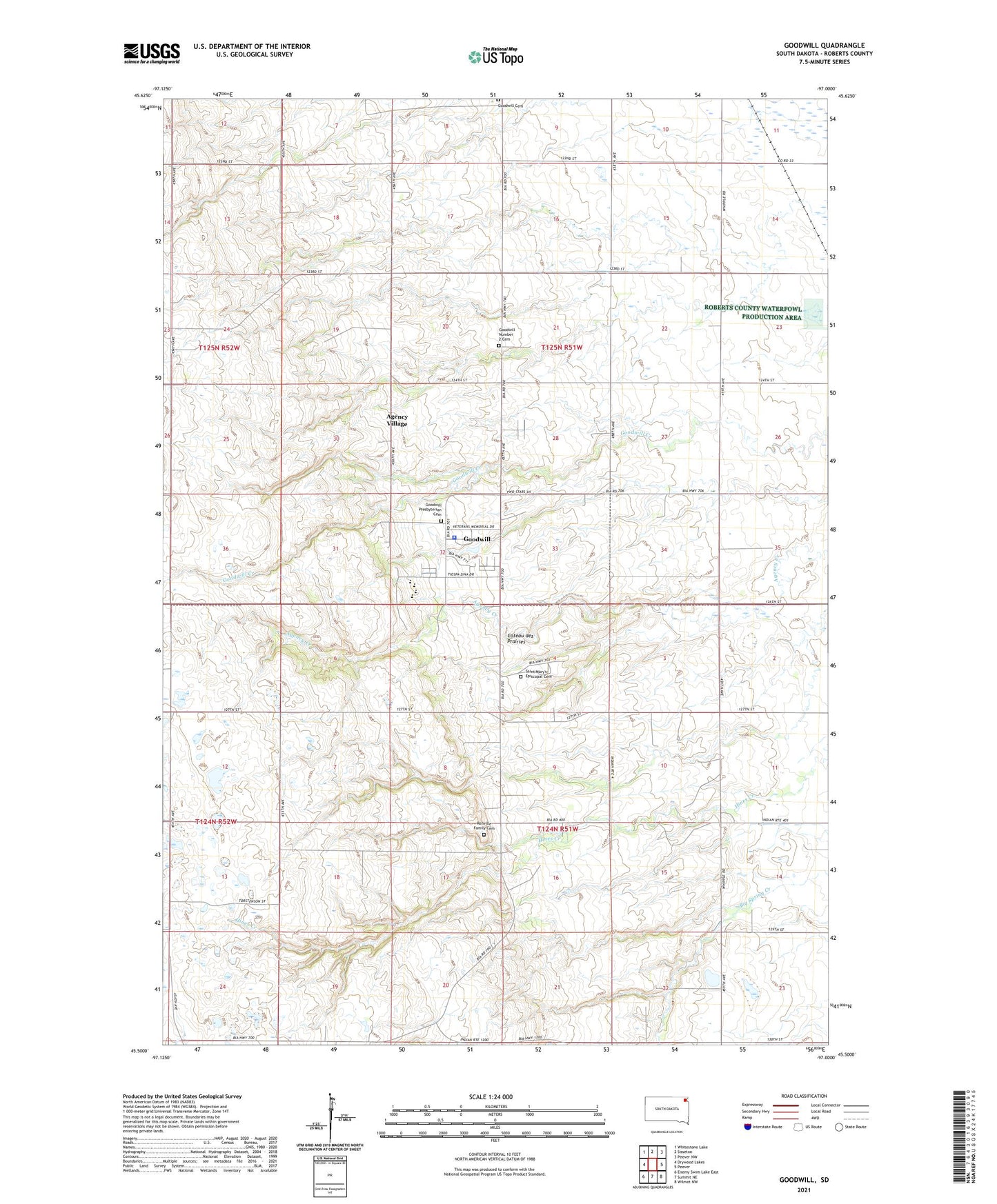
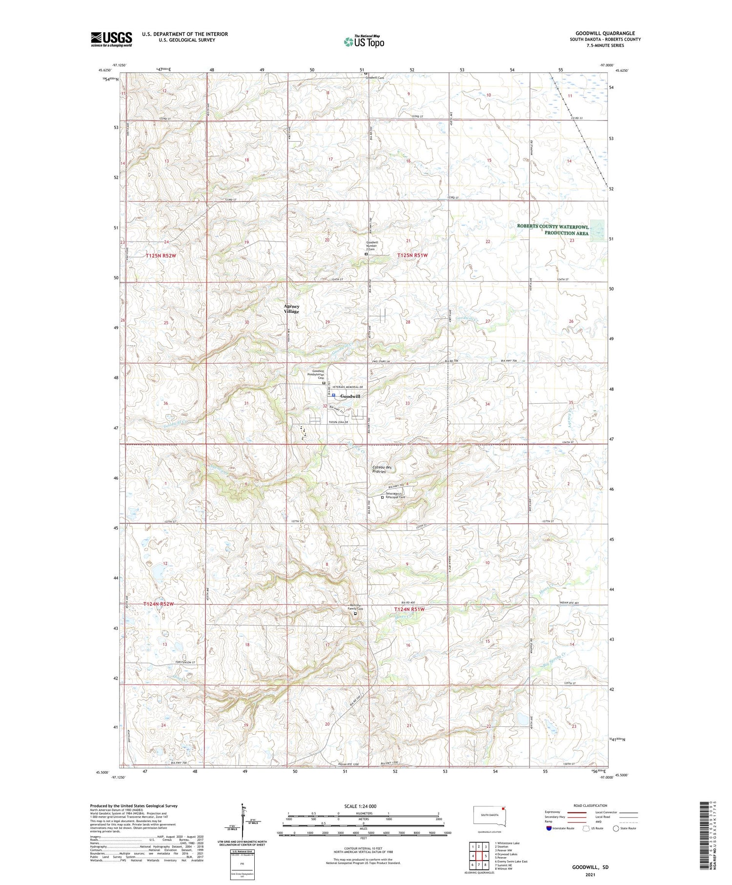
2021 topographic map quadrangle Goodwill in the state of South Dakota. Scale: 1:24000. Based on the newly updated USGS 7.5' US Topo map series, this map is in the following counties: Roberts. The map contains contour data, water features, and other items you are used to seeing on USGS maps, but also has updated roads and other features. This is the next generation of topographic maps. Printed on high-quality waterproof paper with UV fade-resistant inks.
Quads adjacent to this one:
West: Drywood Lakes
Northwest: Whitestone Lake
North: Sisseton
Northeast: Peever NW
East: Peever
Southeast: Wilmot NW
South: Summit NE
Southwest: Enemy Swim Lake East
Contains the following named places: Agency Village Census Designated Place, Goodwill, Goodwill Cemetery, Goodwill Census Designated Place, Goodwill Church, Goodwill Mission Church, Goodwill Number 2 Cemetery, Goodwill Post Office, Goodwill Presbyterian Cemetery, Government Indian School, Indian Mission School, Lohre, Old Agency District, Old Sisseton Indian Agency, Renville Family Cemetery, Saint Marys Church, Saint Mary's Episcopal Cemetery, School Number 1, School Number 2, Sisseton - Wahpeton Sioux Tribal Police Department, Sisseton Wahpeton College, Tiospa Zina Elementary School, Tiospa Zina High School, Tiospa Zina Middle School, Tiospa Zina Primary School, Township of Agency, Township of Goodwill