MyTopo
Whitestone Lake South Dakota US Topo Map
Couldn't load pickup availability
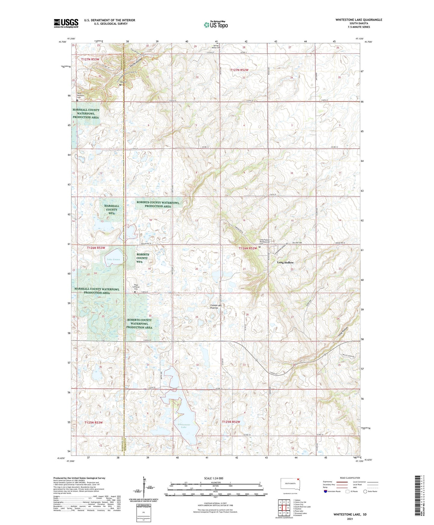
2021 topographic map quadrangle Whitestone Lake in the state of South Dakota. Scale: 1:24000. Based on the newly updated USGS 7.5' US Topo map series, this map is in the following counties: Roberts, Marshall. The map contains contour data, water features, and other items you are used to seeing on USGS maps, but also has updated roads and other features. This is the next generation of topographic maps. Printed on high-quality waterproof paper with UV fade-resistant inks.
Quads adjacent to this one:
West: South Red Iron Lake
Northwest: Veblen
North: Claire City SW
Northeast: Claire City
East: Sisseton
Southeast: Goodwill
South: Drywood Lakes
Southwest: Piyas Lake
This map covers the same area as the classic USGS quad with code o45097f2.
Contains the following named places: Hope Church, Hope Lutheran Cemetery, Lake Emma, Long Hollow Census Designated Place, Long Hollow Church, Long Hollow District, Long Hollow Housing, Long Hollow Presbyterian Cemetery, Roy Cemetery, Saint Benedict Cemetery, Saint Benedict Church, School Number 1, School Number 2, School Number 3, Sieche Hollow State Park, Township of Long Hollow, Whitestone Lake