MyTopo
Pedro SE South Dakota US Topo Map
Couldn't load pickup availability
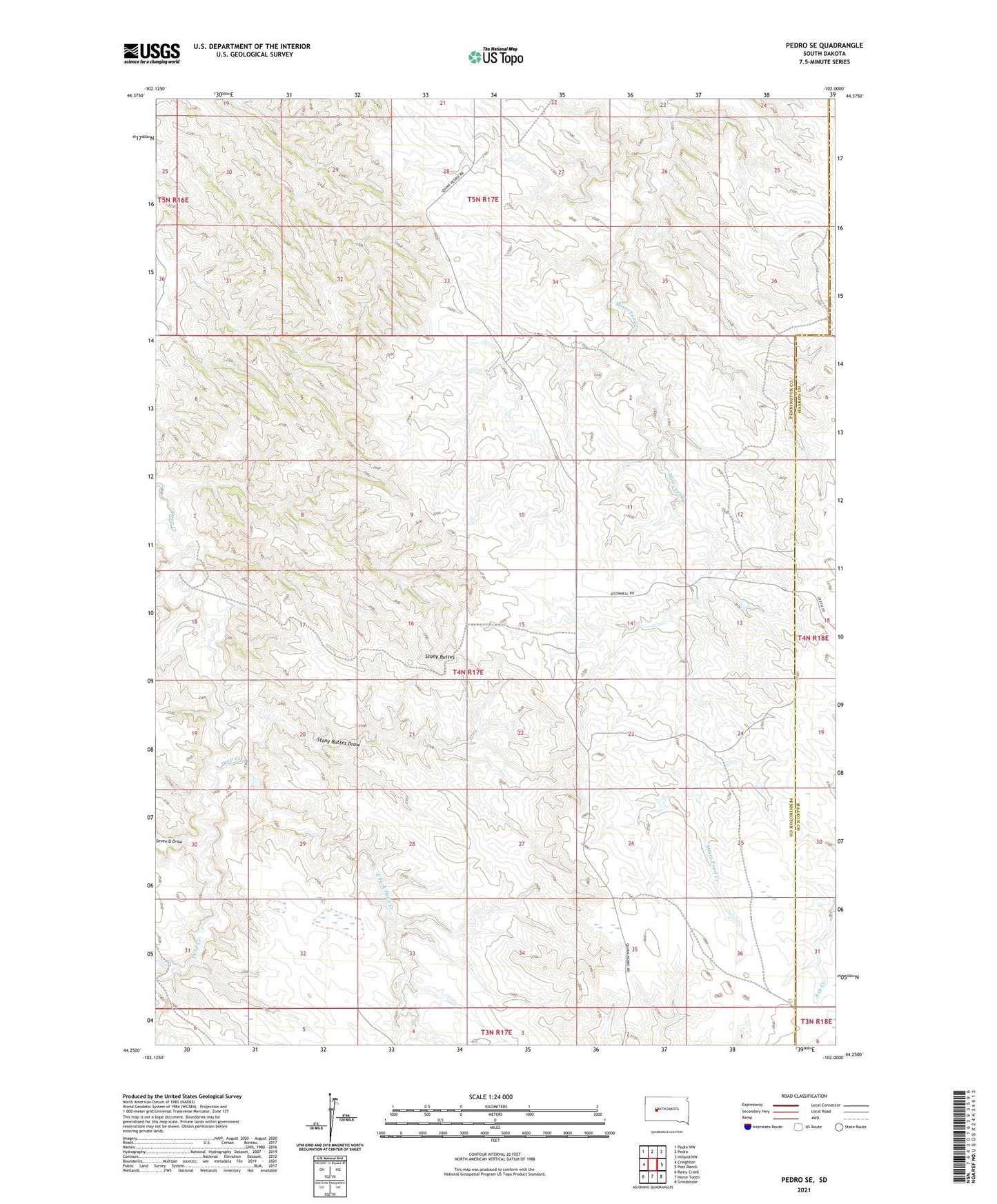
2021 topographic map quadrangle Pedro SE in the state of South Dakota. Scale: 1:24000. Based on the newly updated USGS 7.5' US Topo map series, this map is in the following counties: Pennington, Haakon. The map contains contour data, water features, and other items you are used to seeing on USGS maps, but also has updated roads and other features. This is the next generation of topographic maps. Printed on high-quality waterproof paper with UV fade-resistant inks.
Quads adjacent to this one:
West: Creighton
Northwest: Pedro NW
North: Pedro
Northeast: Hilland NW
East: Post Ranch
Southeast: Grindstone
South: Horse Tooth
Southwest: Rainy Creek
This map covers the same area as the classic USGS quad with code o44102c1.
Contains the following named places: Dale Ranch, Dannie O'Connell Dam, East Fork Deep Creek, Erickson Ranch, Gabriel Ranch, Kirk Cordes Dam, Kirk Cordes Number 30 Reservoir, Knutson Ranch, O'Connell Ranch, Paulson Ranch, Pleasant View School, Seven D Draw, Stony Buttes, Stony Buttes Draw, Strandell Ranch, Unorganized Territory of Northeast Pennington