MyTopo
Humboldt South Dakota US Topo Map
Couldn't load pickup availability
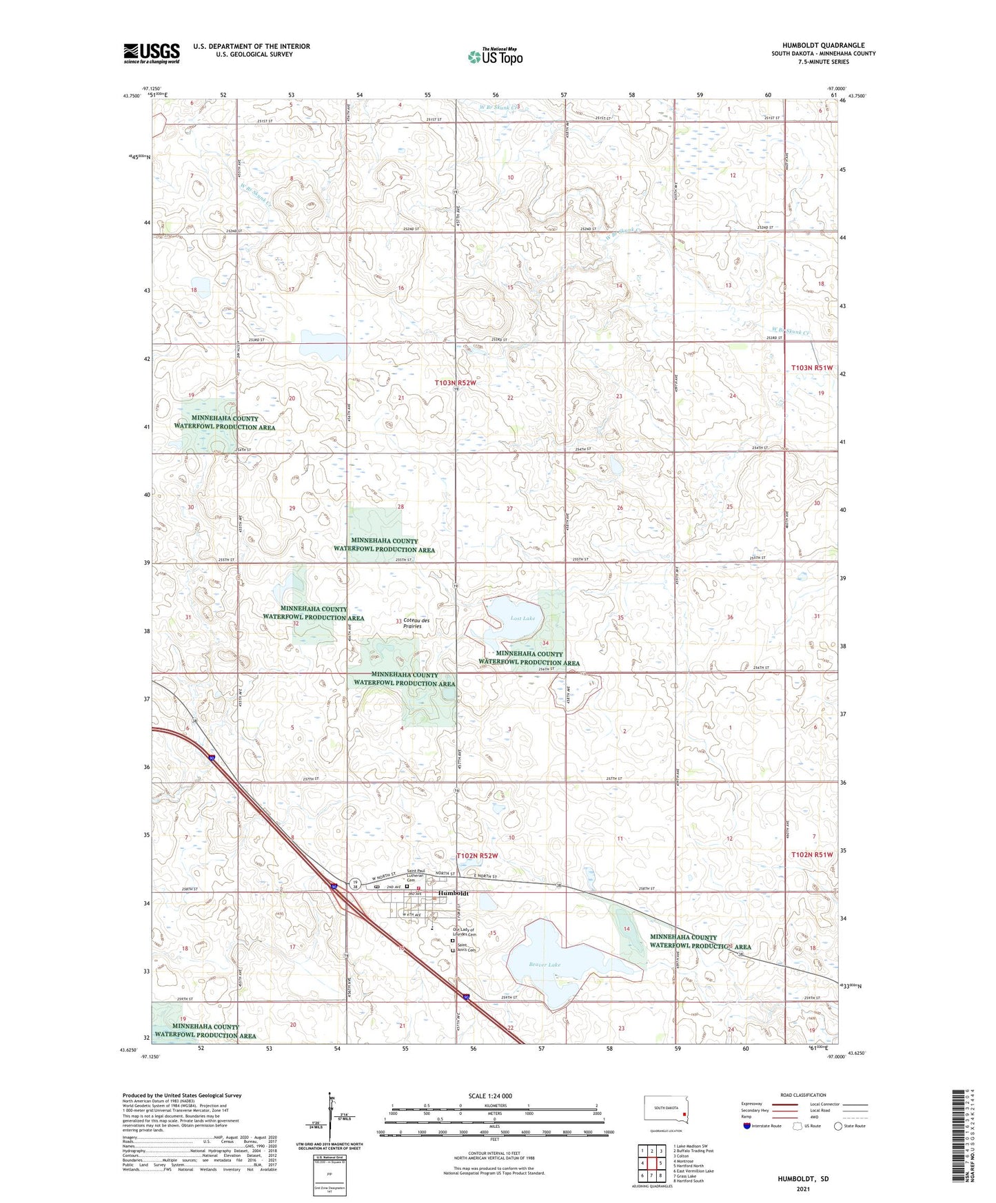
2021 topographic map quadrangle Humboldt in the state of South Dakota. Scale: 1:24000. Based on the newly updated USGS 7.5' US Topo map series, this map is in the following counties: Minnehaha. The map contains contour data, water features, and other items you are used to seeing on USGS maps, but also has updated roads and other features. This is the next generation of topographic maps. Printed on high-quality waterproof paper with UV fade-resistant inks.
Quads adjacent to this one:
West: Montrose
Northwest: Lake Madison SW
North: Buffalo Trading Post
Northeast: Colton
East: Hartford North
Southeast: Hartford South
South: Grass Lake
Southwest: East Vermillion Lake
This map covers the same area as the classic USGS quad with code o43097f1.
Contains the following named places: Beaver Lake, Humboldt, Humboldt Branch Library, Humboldt City Hall, Humboldt Elementary School, Humboldt Fire and Ambulance Service, Humboldt Post Office, Humboldt Public Cemetery, KIOV-FM (Sioux Falls), Lost Lake, Mount Pleasant School, Our Lady of Lourdes Cemetery, Saint Ann's Cemetery, Saint Paul Lutheran Cemetery, School Number 103, Town of Humboldt, Township of Clear Lake, Township of Humboldt, Western Mall, ZIP Code: 57035