MyTopo
Hartford North South Dakota US Topo Map
Couldn't load pickup availability
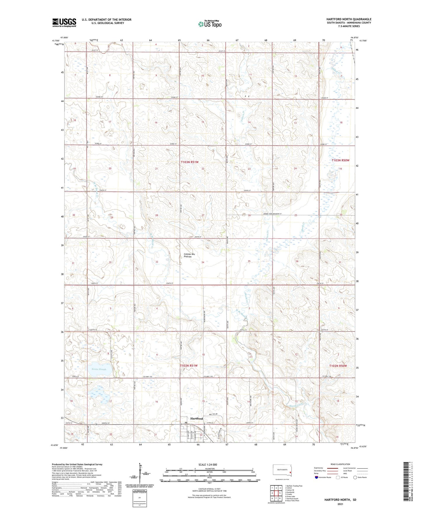
2021 topographic map quadrangle Hartford North in the state of South Dakota. Scale: 1:24000. Based on the newly updated USGS 7.5' US Topo map series, this map is in the following counties: Minnehaha. The map contains contour data, water features, and other items you are used to seeing on USGS maps, but also has updated roads and other features. This is the next generation of topographic maps. Printed on high-quality waterproof paper with UV fade-resistant inks.
Quads adjacent to this one:
West: Humboldt
Northwest: Buffalo Trading Post
North: Colton
Northeast: Colton SE
East: Crooks
Southeast: Sioux Falls West
South: Hartford South
Southwest: Grass Lake
This map covers the same area as the classic USGS quad with code o43096f8.
Contains the following named places: Colton Creek, Ginsbach School, Grand Meadow, Hartford Post Office, Lyons, McLeod School, School Number 91, Scotts Slough, Township of Grand Meadow, Township of Hartford, Tri-Valley Elementary School, Tri-Valley High School, Tri-Valley Junior High School, West Branch Skunk Creek