MyTopo
Hartford South South Dakota US Topo Map
Couldn't load pickup availability
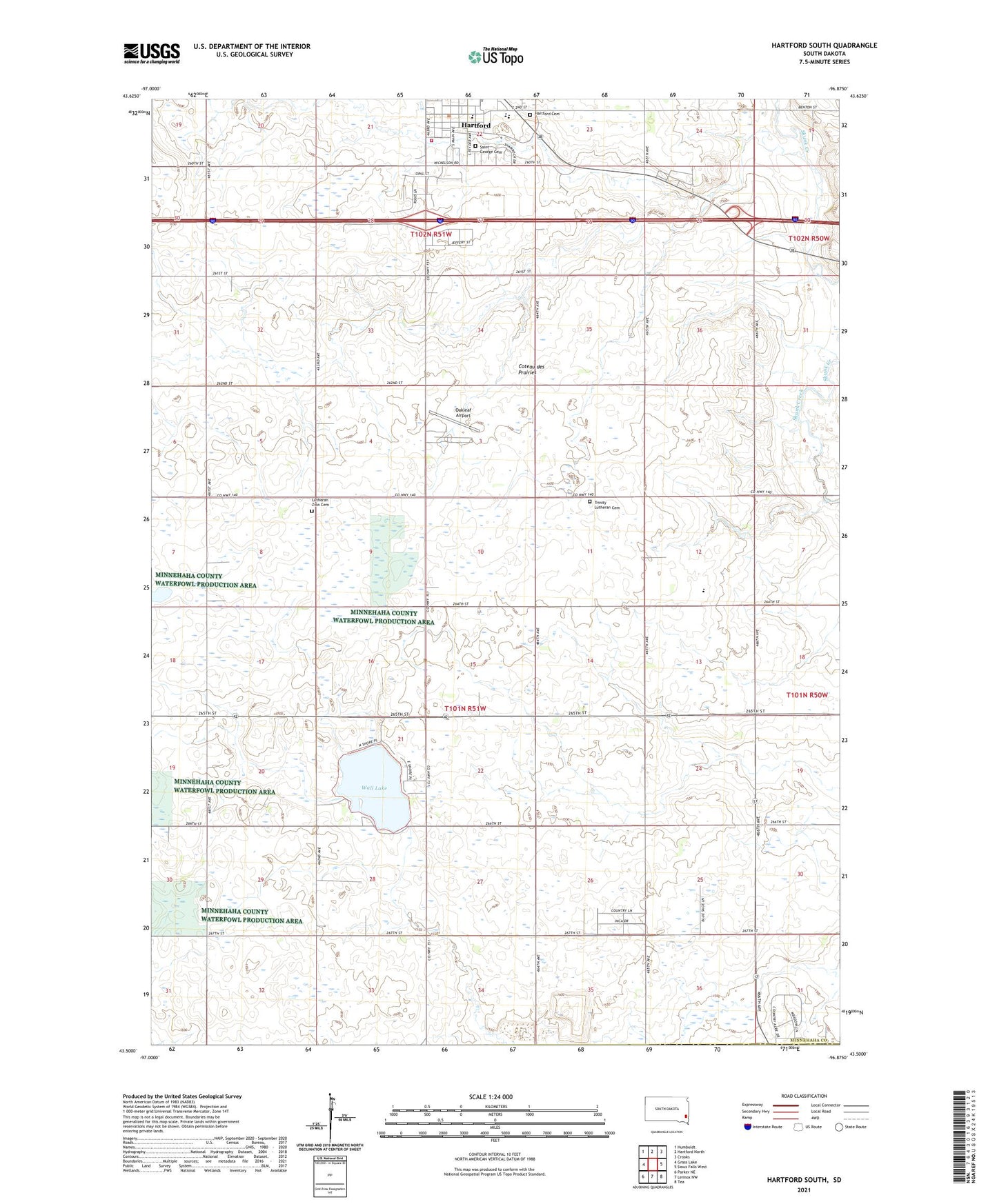
2021 topographic map quadrangle Hartford South in the state of South Dakota. Scale: 1:24000. Based on the newly updated USGS 7.5' US Topo map series, this map is in the following counties: Minnehaha, Lincoln, Turner. The map contains contour data, water features, and other items you are used to seeing on USGS maps, but also has updated roads and other features. This is the next generation of topographic maps. Printed on high-quality waterproof paper with UV fade-resistant inks.
Quads adjacent to this one:
West: Grass Lake
Northwest: Humboldt
North: Hartford North
Northeast: Crooks
East: Sioux Falls West
Southeast: Tea
South: Lennox NW
Southwest: Parker NE
This map covers the same area as the classic USGS quad with code o43096e8.
Contains the following named places: Buffalo Ridge, City of Hartford, Country Acres, Hartford, Hartford Area Fire and Rescue, Hartford Cemetery, Hartford City Hall, Hartford Elementary School, Hartford-West Central Branch Library, Johnson School, Lake City, Lakeview School, Lutheran Zion Cemetery, Oakleaf Airport, Penitentiary Farms, Saint George Cemetery, School Number 61, Sunshine School, Township of Wall Lake, Trinity Church, Trinity Lutheran Cemetery, Turtle Creek, Wall Lake, West Central High School, West Central Middle School, Zion Church, ZIP Code: 57033