MyTopo
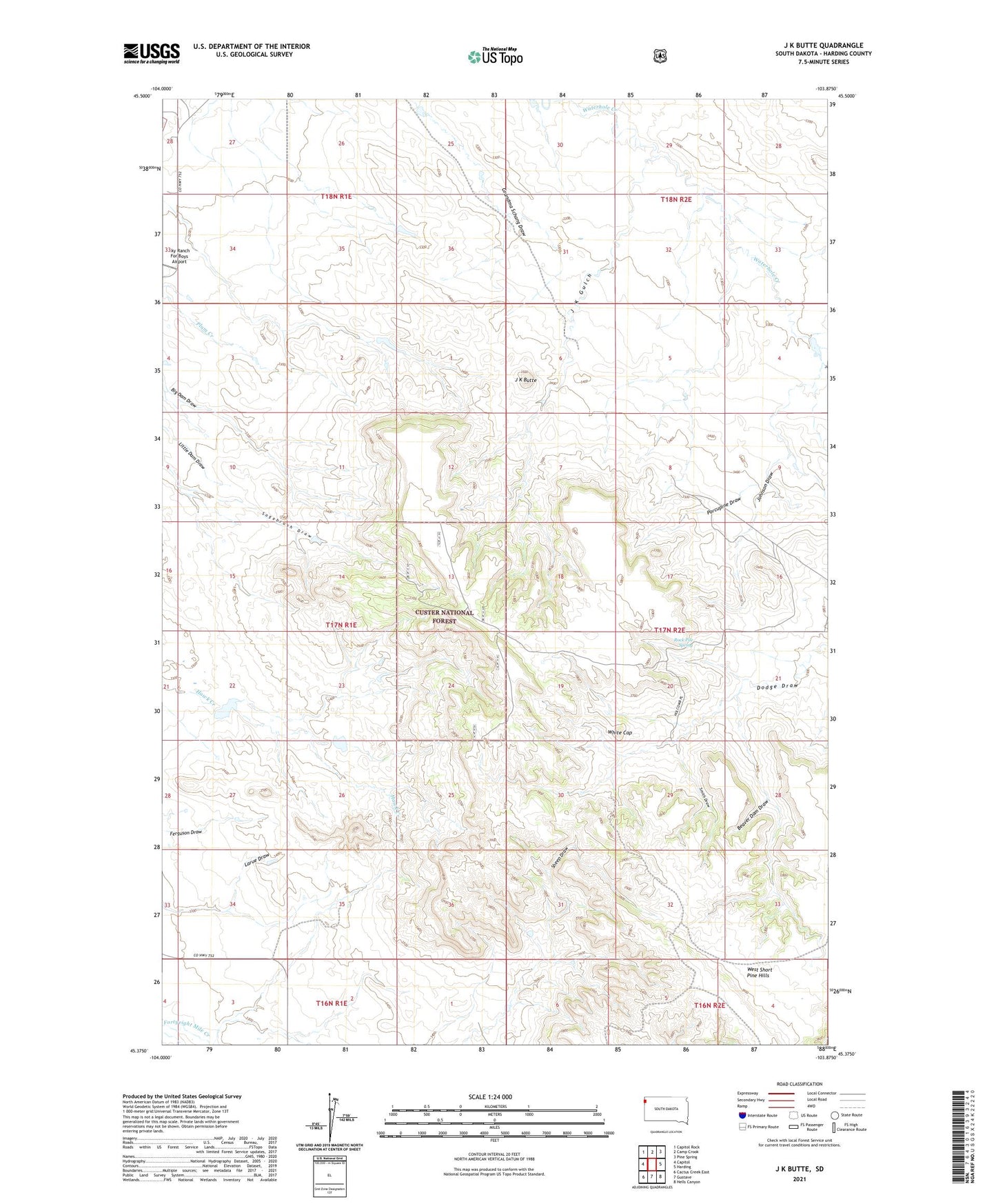
J K Butte South Dakota US Topo Map
Couldn't load pickup availability
Also explore the J K Butte Forest Service Topo of this same quad for updated USFS data
2021 topographic map quadrangle J K Butte in the state of South Dakota. Scale: 1:24000. Based on the newly updated USGS 7.5' US Topo map series, this map is in the following counties: Harding. The map contains contour data, water features, and other items you are used to seeing on USGS maps, but also has updated roads and other features. This is the next generation of topographic maps. Printed on high-quality waterproof paper with UV fade-resistant inks.
Quads adjacent to this one:
West: Capitol
Northwest: Capitol Rock
North: Camp Crook
Northeast: Pine Spring
East: Harding
Southeast: Hells Canyon
South: Gustave
Southwest: Cactus Creek East
This map covers the same area as the classic USGS quad with code o45103d8.
Contains the following named places: Beaver Dam Draw, Davis Ranch, Holcomb Ranch, J K Butte, J K Gulch, Johnson Draw, Mud Butte Dam, Porcupine Draw, Rock Pile Spring, Short Pines Gas Field, Smith Draw, West Short Pine Hills, White Cap