MyTopo
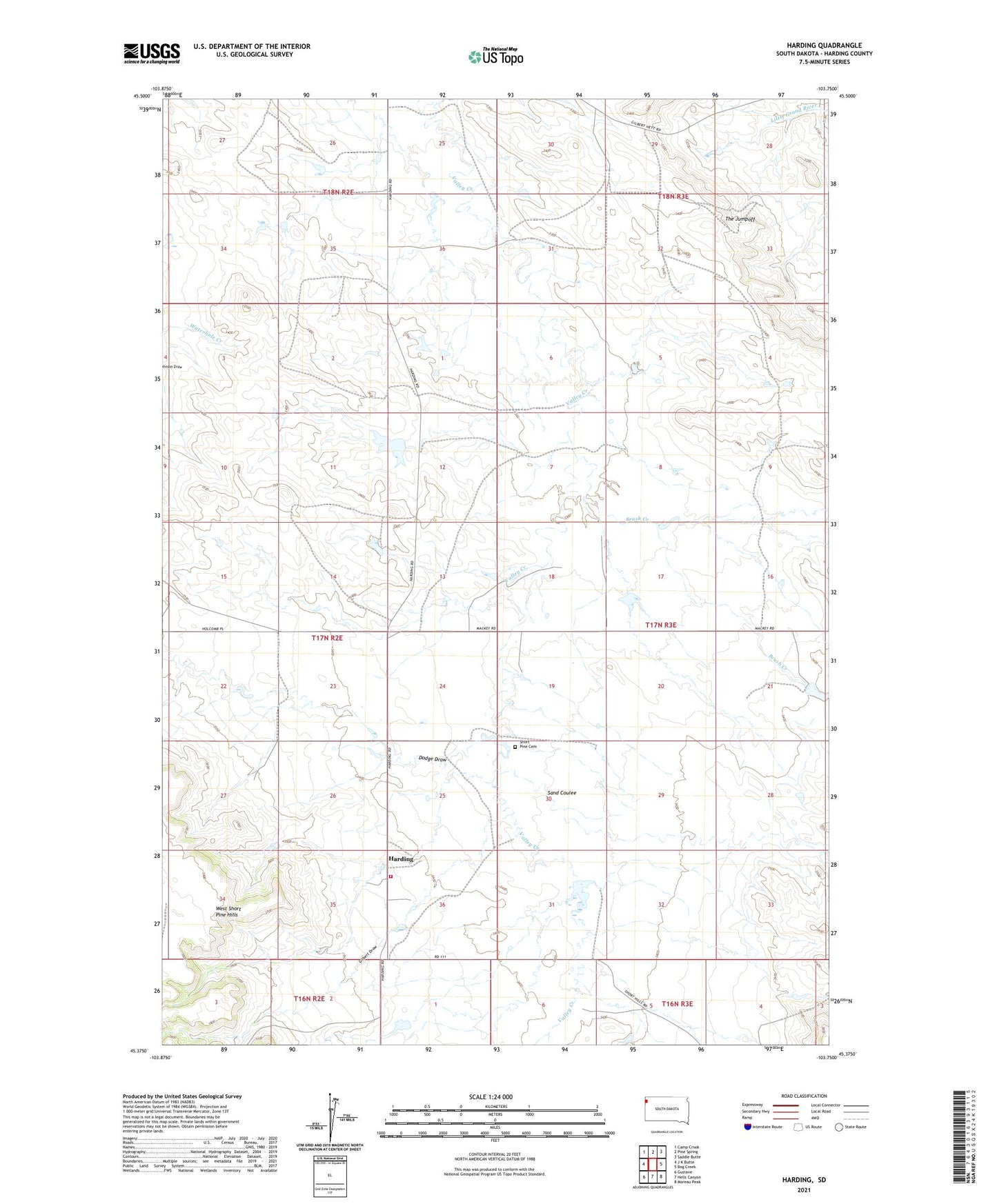
Harding South Dakota US Topo Map
Couldn't load pickup availability
Also explore the Harding Forest Service Topo of this same quad for updated USFS data
2021 topographic map quadrangle Harding in the state of South Dakota. Scale: 1:24000. Based on the newly updated USGS 7.5' US Topo map series, this map is in the following counties: Harding. The map contains contour data, water features, and other items you are used to seeing on USGS maps, but also has updated roads and other features. This is the next generation of topographic maps. Printed on high-quality waterproof paper with UV fade-resistant inks.
Quads adjacent to this one:
West: J K Butte
Northwest: Camp Crook
North: Pine Spring
Northeast: Saddle Butte
East: Bog Creek
Southeast: Moreau Peak
South: Hells Canyon
Southwest: Gustave
This map covers the same area as the classic USGS quad with code o45103d7.
Contains the following named places: Brant School, Brush Creek, Dodge Draw, Floyd Cooper Dam, Gilbert Draw, Harding, Harding Volunteer Fire Department, John Catron Number 1 Dam, John Catron Number 2 Dam, Sand Coulee, Short Pine Cemetery, The Jumpoff