MyTopo
Jamesville South Dakota US Topo Map
Couldn't load pickup availability
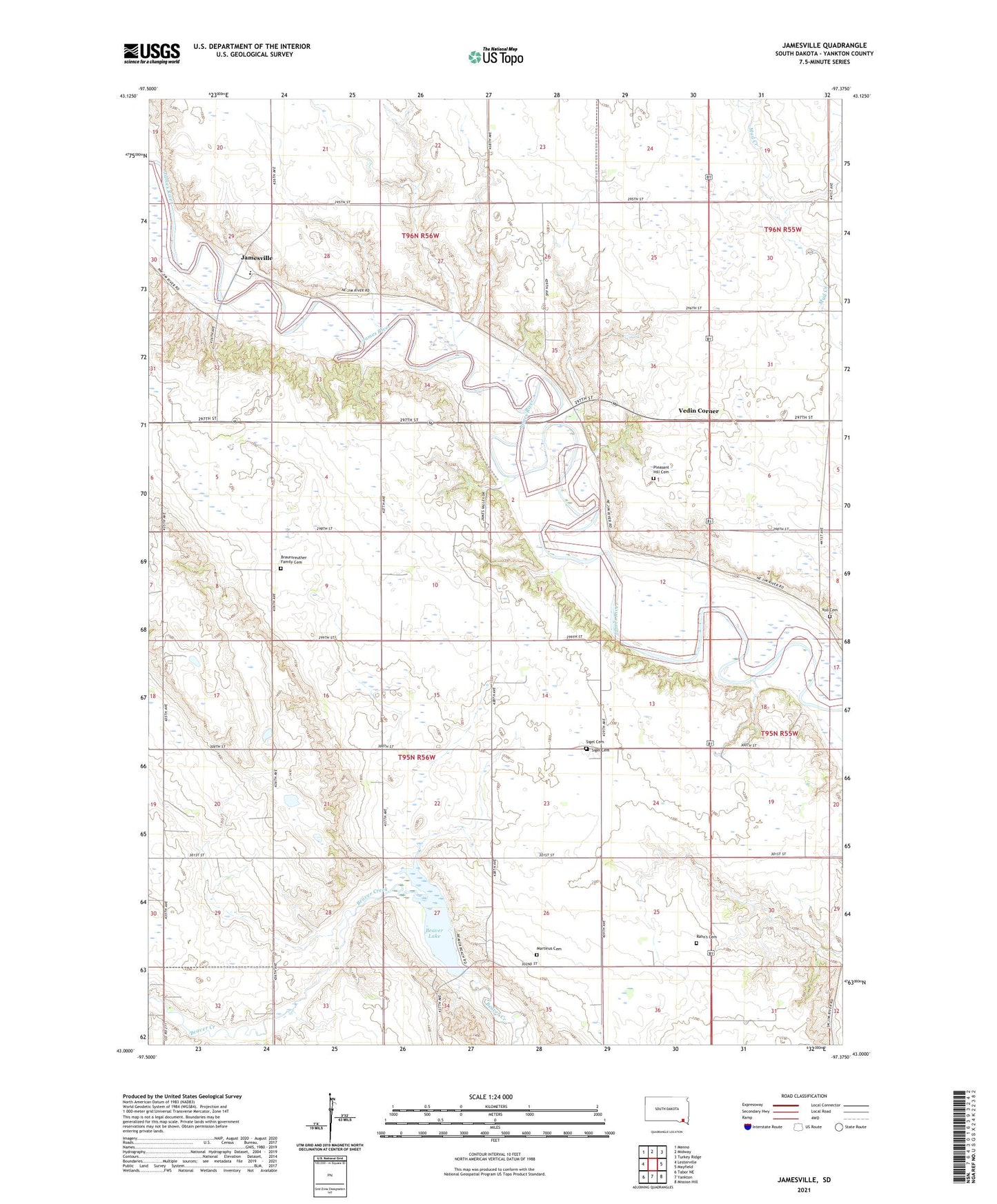
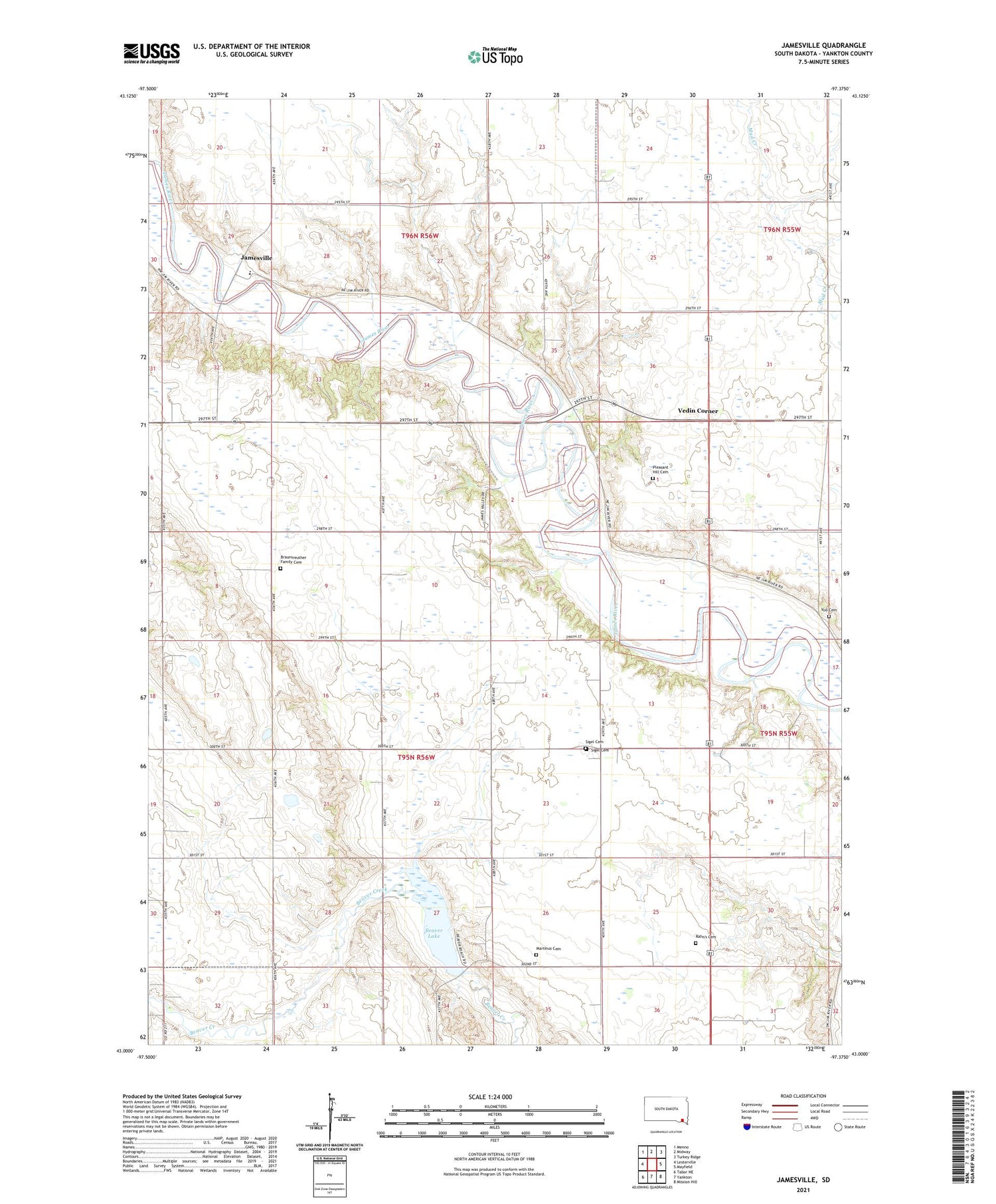
2021 topographic map quadrangle Jamesville in the state of South Dakota. Scale: 1:24000. Based on the newly updated USGS 7.5' US Topo map series, this map is in the following counties: Yankton. The map contains contour data, water features, and other items you are used to seeing on USGS maps, but also has updated roads and other features. This is the next generation of topographic maps. Printed on high-quality waterproof paper with UV fade-resistant inks.
Quads adjacent to this one:
West: Lesterville
Northwest: Menno
North: Midway
Northeast: Turkey Ridge
East: Mayfield
Southeast: Mission Hill
South: Yankton
Southwest: Tabor NE
Contains the following named places: Anderson School, Beaver Dam, Beaver Lake, Braunsreuther Family Cemetery, Fairyview School, Huber School, Jamesville, Jamesville Colony, Jamesville Colony Census Designated Place, Jamesville Colony Elementary School, Jamesville Colony High School, Kietzman School, Klimisch School, Martinus Cemetery, Martinus Church, Pike School, Pleasant Hill Cemetery, Sigel, Sigel Cemetery, Sigel Church, Township of Central, Vedin Corner, Voll Cemetery, Yankton County, ZIP Code: 57067