MyTopo
Hurley South Dakota US Topo Map
Couldn't load pickup availability
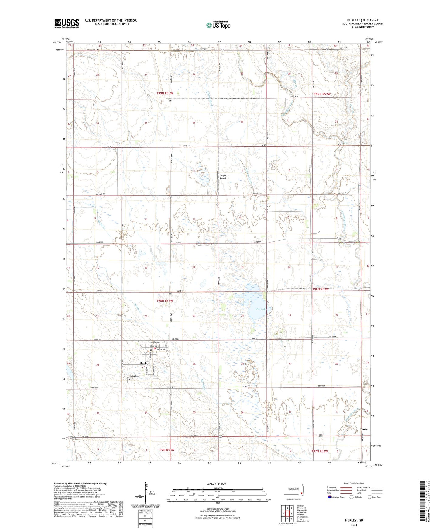
2021 topographic map quadrangle Hurley in the state of South Dakota. Scale: 1:24000. Based on the newly updated USGS 7.5' US Topo map series, this map is in the following counties: Turner. The map contains contour data, water features, and other items you are used to seeing on USGS maps, but also has updated roads and other features. This is the next generation of topographic maps. Printed on high-quality waterproof paper with UV fade-resistant inks.
Quads adjacent to this one:
West: Parker SW
Northwest: Parker
North: Parker NE
Northeast: Lennox NW
East: Lennox
Southeast: Beresford NW
South: Viborg
Southwest: Center Point
This map covers the same area as the classic USGS quad with code o43097c1.
Contains the following named places: Alberty Ditch, Camp Creek, City of Hurley, Dangel Airport, Davis City Police Department, Elce Creek, Hurley, Hurley Ambulance Service, Hurley Cemetery, Hurley City Hall, Hurley Elementary School, Hurley Fire Department, Hurley High School, Hurley Junior High School, Hurley Post Office, Hurley Public Library, Mud Lake, Nelson Historical Museum, Stoddard School, Township of Hurley