MyTopo
Marty South Dakota US Topo Map
Couldn't load pickup availability
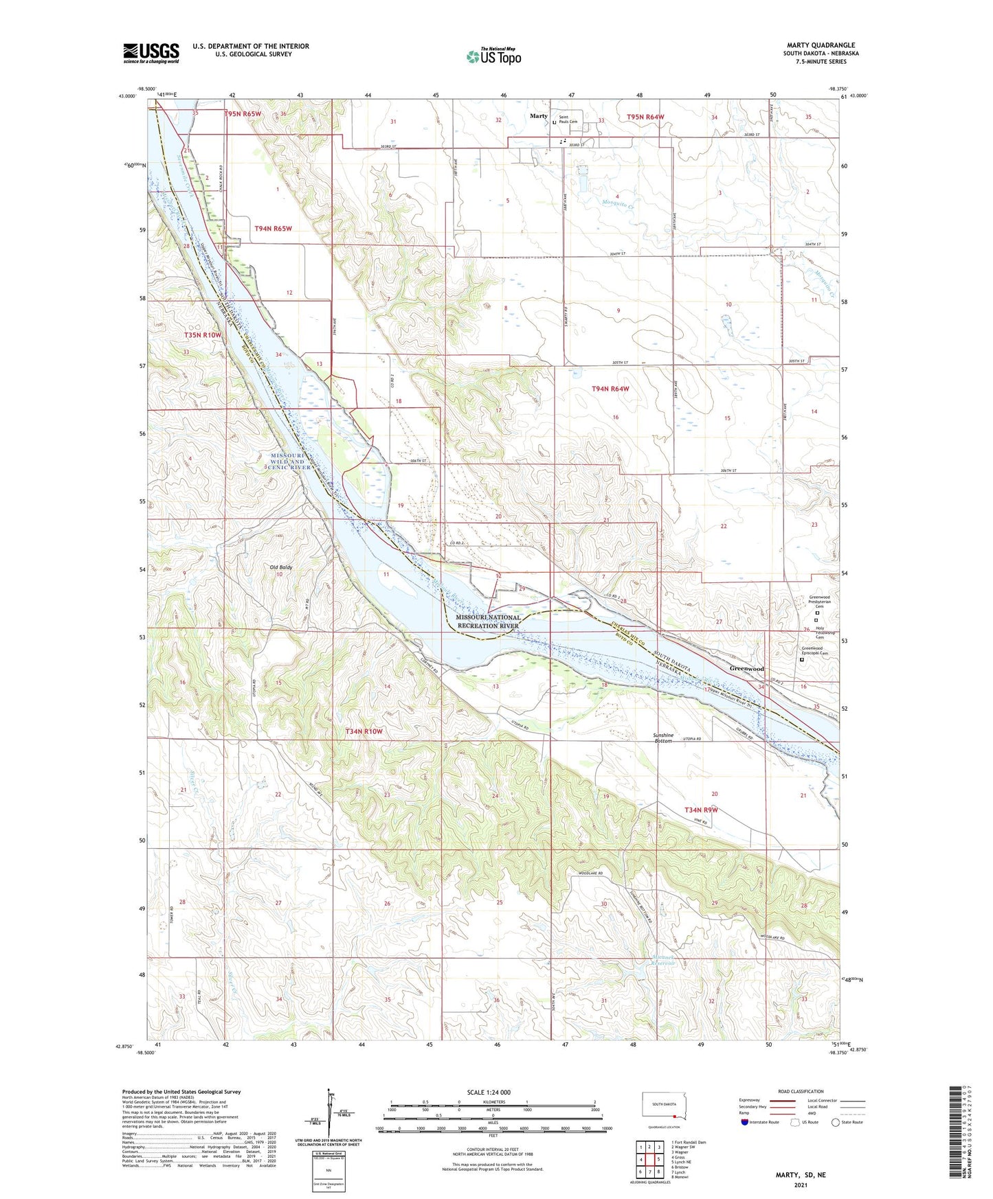
2021 topographic map quadrangle Marty in the states of Nebraska, South Dakota. Scale: 1:24000. Based on the newly updated USGS 7.5' US Topo map series, this map is in the following counties: Charles Mix, Boyd, Gregory. The map contains contour data, water features, and other items you are used to seeing on USGS maps, but also has updated roads and other features. This is the next generation of topographic maps. Printed on high-quality waterproof paper with UV fade-resistant inks.
Quads adjacent to this one:
West: Gross
Northwest: Fort Randall Dam
North: Wagner SW
Northeast: Wagner
East: Lynch NE
Southeast: Monowi
South: Lynch
Southwest: Bristow
Contains the following named places: Greenwood, Greenwood Episcopal Cemetery, Greenwood Presbyterian Cemetery, Holy Fellowship Cemetery, Marty, Marty Census Designated Place, Marty Elementary School, Marty Indian School, Marty Middle School, Marty Post Office, Micanek Reservoir, Michanek Dam, Old Baldy, Saint Pauls Cemetery, School Number 81, School Number 82, School Number 83, Sevenmile Creek, Sunshine Bottom, Township of Mullen, Township of Wahehe, ZIP Code: 57361