MyTopo
Maurice South Dakota US Topo Map
Couldn't load pickup availability
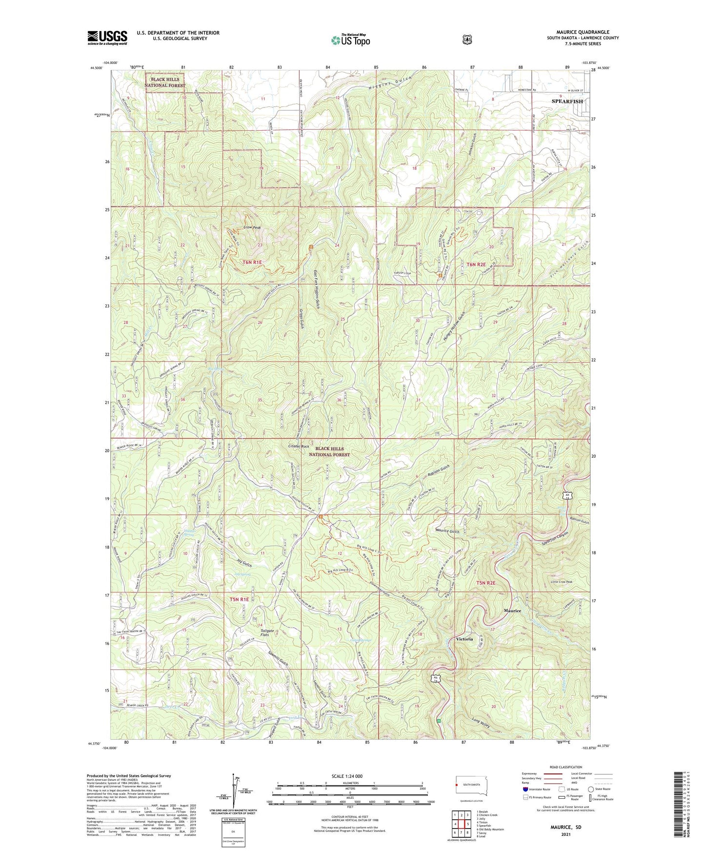
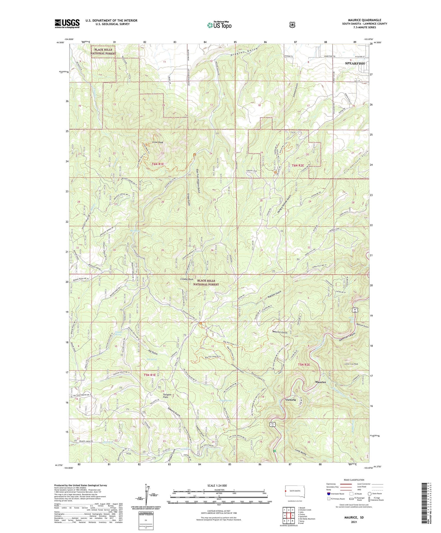
2021 topographic map quadrangle Maurice in the state of South Dakota. Scale: 1:24000. Based on the newly updated USGS 7.5' US Topo map series, this map is in the following counties: Lawrence. The map contains contour data, water features, and other items you are used to seeing on USGS maps, but also has updated roads and other features. This is the next generation of topographic maps. Printed on high-quality waterproof paper with UV fade-resistant inks.
Quads adjacent to this one:
West: Tinton
Northwest: Beulah
North: Chicken Creek
Northeast: Jolly
East: Spearfish
Southeast: Lead
South: Savoy
Southwest: Old Baldy Mountain
Contains the following named places: Big Hill Ski Trail, Big Spring, Bridal Veil Falls, Cabin Springs, Citadel Rock, Cleopatra Creek, Cleopatra Mine, Crow Peak, Deer Creek, East Fork Higgins Gulch, Eleven Hour Gulch, Griggs Gulch, Higgins Spring, Homestake Camp, Jay Gulch, Jay Spring, Johnston Gulch, Little Crow Peak, Long Valley, Maurice, Maurice Gulch, Prospect Gulch, Redpath Creek, Rubicon Gulch, Sawmill Gulch, Seamore Gulch, Tollgate Flats, Unorganized Territory of North Lawrence, Victoria, Vitoria Mine, ZIP Code: 57783