MyTopo
Beulah Wyoming US Topo Map
Couldn't load pickup availability
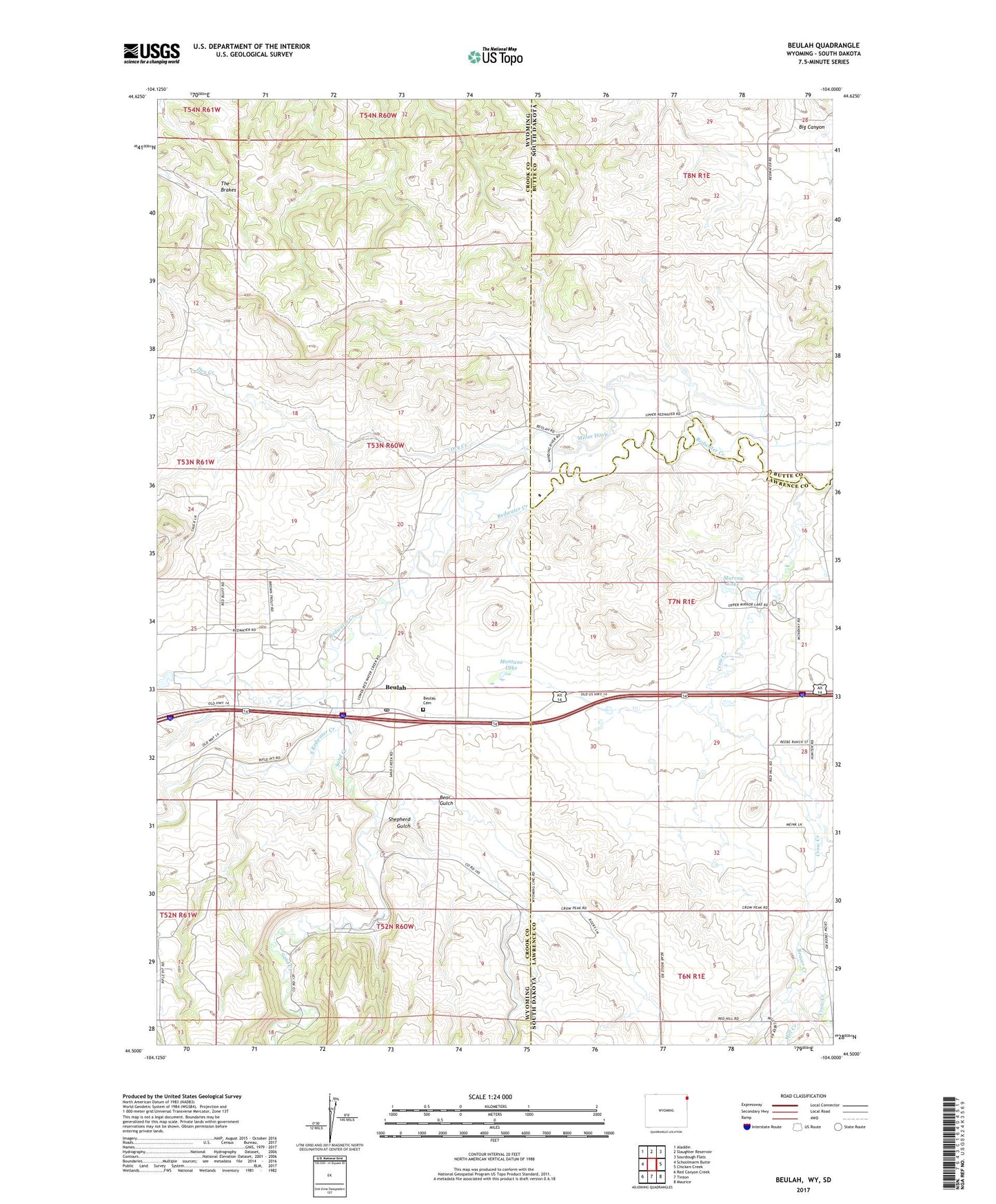
2021 topographic map quadrangle Beulah in the states of Wyoming, South Dakota. Scale: 1:24000. Based on the newly updated USGS 7.5' US Topo map series, this map is in the following counties: Crook, Lawrence, Butte. The map contains contour data, water features, and other items you are used to seeing on USGS maps, but also has updated roads and other features. This is the next generation of topographic maps. Printed on high-quality waterproof paper with UV fade-resistant inks.
Quads adjacent to this one:
West: Schoolmarm Butte
Northwest: Aladdin
North: Slaughter Reservoir
Northeast: Sourdough Flats
East: Chicken Creek
Southeast: Maurice
South: Tinton
Southwest: Red Canyon Creek
This map covers the same area as the classic USGS quad with code o44104e1.
Contains the following named places: Bear Gulch, Beaver Creek, Beaver Creek School, Beulah, Beulah Cemetery, Beulah Census Designated Place, Beulah Post Office, Crow Creek, Dry Creek, McNenny Fish Hatchery, Mill Creek, Miller Ditch, Montana Lake, Murray Lake, Redwater Creek, Sand Creek, Shepherd Gulch, South Redwater Creek, State Wildlife Management Area, The Brakes