MyTopo
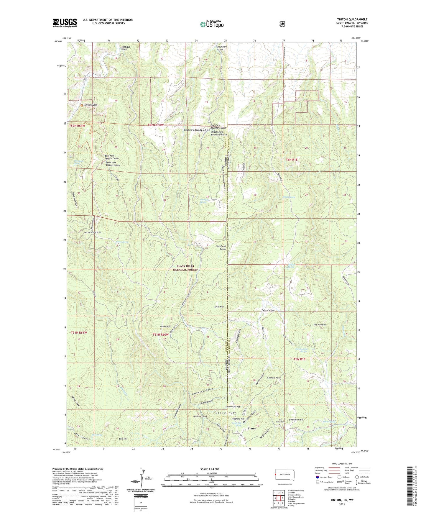
Tinton South Dakota US Topo Map
Couldn't load pickup availability
Also explore the Tinton Forest Service Topo of this same quad for updated USFS data
2021 topographic map quadrangle Tinton in the states of Wyoming, South Dakota. Scale: 1:24000. Based on the newly updated USGS 7.5' US Topo map series, this map is in the following counties: Lawrence, Crook. The map contains contour data, water features, and other items you are used to seeing on USGS maps, but also has updated roads and other features. This is the next generation of topographic maps. Printed on high-quality waterproof paper with UV fade-resistant inks.
Quads adjacent to this one:
West: Red Canyon Creek
Northwest: Schoolmarm Butte
North: Beulah
Northeast: Chicken Creek
East: Maurice
Southeast: Savoy
South: Old Baldy Mountain
Southwest: Moskee
Contains the following named places: Apex Mine, Bear Gulch Cemetery, Bear Gulch I, Bear Gulch Placer Mine, Bear Gulch Trail, Beartown Hill, Beaver Crossing, Beaver Ridge Trail, Boundary Gulch, Boundary Spring, Bull Hill, Bull Hill Mine, C Nicholas Ranch, Centennial Gulch, Centennial Spring, Chicago Gulch, Christianson Spring, Conners Rock, Cummins Gulch, Dugout Gulch, East Fork Boundary Gulch, East Fork Dugout Gulch, Eureka Number Mine, Giant Mine, Grandview Hill, Green Hill, Hospital Gulch, Idol Spring, J Miller Ranch, Knight Spring, Lincoln Gulch, Lytle Hill, Mallory Gulch, Middle Fork Boundary Gulch, Miller Ranch, Negro Gulch, Negro Hill, Nelson Spring, Potato Creek, Potato Spring, Ranch A, Ranch A National Fish Genetics Laboratory, Roena Gulch, Rusty Number 9 Mine, S Nicholas Ranch, Saffron Gulch, Sand Creek Crossing, Seventy Flats, Soldiers Spring, Spottedtail Gulch, Sunshine Hill, The Needles, Thompson Spring, Tinton, Tinton Mine, West Fork Boundary Gulch, West Fork Dugout Gulch, Wyoming Gulch, ZIP Code: 82712