MyTopo
Jolly South Dakota US Topo Map
Couldn't load pickup availability
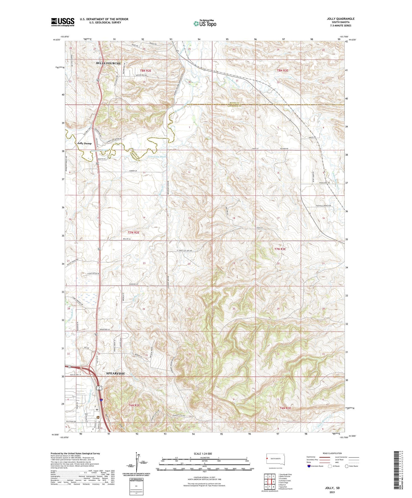
2021 topographic map quadrangle Jolly in the state of South Dakota. Scale: 1:24000. Based on the newly updated USGS 7.5' US Topo map series, this map is in the following counties: Lawrence, Butte. The map contains contour data, water features, and other items you are used to seeing on USGS maps, but also has updated roads and other features. This is the next generation of topographic maps. Printed on high-quality waterproof paper with UV fade-resistant inks.
Quads adjacent to this one:
West: Chicken Creek
Northwest: Sourdough Flats
North: Belle Fourche
Northeast: Fruitdale
East: Saint Onge
Southeast: Deadwood North
South: Spearfish
Southwest: Maurice
This map covers the same area as the classic USGS quad with code o44103e7.
Contains the following named places: Black Hills RC and D Stabilization Dam, Columbus Mine, Concordia Ditch, Creekside Elementary School, False Bottom Creek, Jolly, Jolly Dump, Spearfish Creek, Spearfish High School, Spearfish Middle School, Spearfish Post Office, Spearfish Valley Ranch Dam, Spring Creek, Spring Creek School, Todd School, White School, ZIP Code: 57779