MyTopo
Chicken Creek South Dakota US Topo Map
Couldn't load pickup availability
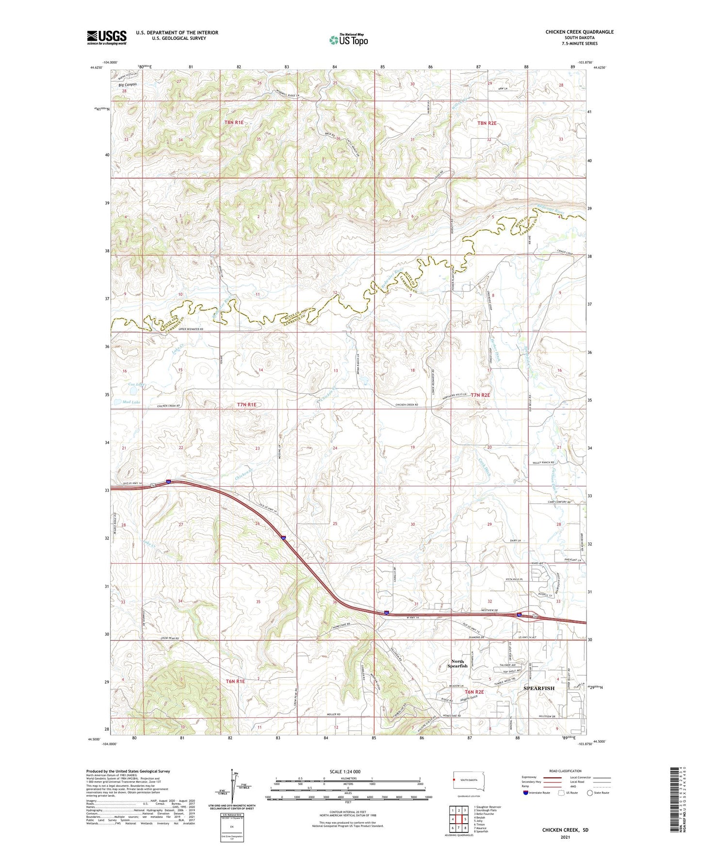
2021 topographic map quadrangle Chicken Creek in the state of South Dakota. Scale: 1:24000. Based on the newly updated USGS 7.5' US Topo map series, this map is in the following counties: Lawrence, Butte. The map contains contour data, water features, and other items you are used to seeing on USGS maps, but also has updated roads and other features. This is the next generation of topographic maps. Printed on high-quality waterproof paper with UV fade-resistant inks.
Quads adjacent to this one:
West: Beulah
Northwest: Slaughter Reservoir
North: Sourdough Flats
Northeast: Belle Fourche
East: Jolly
Southeast: Spearfish
South: Maurice
Southwest: Tinton
This map covers the same area as the classic USGS quad with code o44103e8.
Contains the following named places: Carlson Ditch, Chicken Creek, Cook Ditch, Cox Lake, Herber Ditch, Higgins Gulch, Lake Creek, Mud Lake, North Spearfish Census Designated Place, Thompson Ditch, Wells School