MyTopo
Mission NE South Dakota US Topo Map
Couldn't load pickup availability
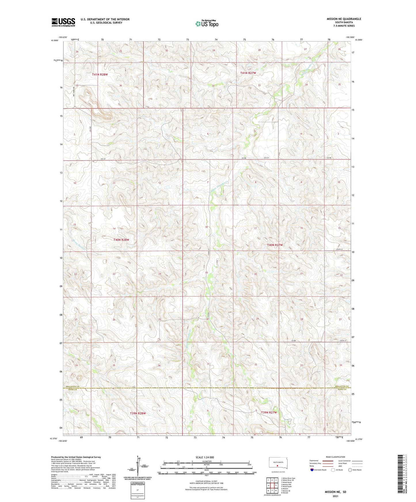
2021 topographic map quadrangle Mission NE in the state of South Dakota. Scale: 1:24000. Based on the newly updated USGS 7.5' US Topo map series, this map is in the following counties: Mellette, Todd. The map contains contour data, water features, and other items you are used to seeing on USGS maps, but also has updated roads and other features. This is the next generation of topographic maps. Printed on high-quality waterproof paper with UV fade-resistant inks.
Quads adjacent to this one:
West: Mission NW
Northwest: White River East
North: White River SE
Northeast: Wood North
East: Wood South
Southeast: Okreek
South: Mission SE
Southwest: Mission
This map covers the same area as the classic USGS quad with code o43100d5.
Contains the following named places: Bechtold Ranch, Collins Ranch, Draine Ranch, Dvorak Ranch, Fox Ranch, Gifford Number 1 Dam, Gifford Ranch, Lauritsen Ranch, Medearis Ranch, Piper Ranch, Siegmunds Ranch, Township of Fairview, Township of Pure Water, Tucker Ranch