MyTopo
Mission NW South Dakota US Topo Map
Couldn't load pickup availability
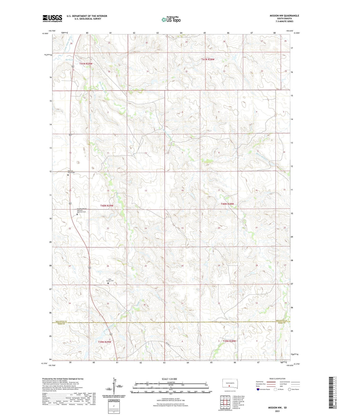
2021 topographic map quadrangle Mission NW in the state of South Dakota. Scale: 1:24000. Based on the newly updated USGS 7.5' US Topo map series, this map is in the following counties: Mellette, Todd. The map contains contour data, water features, and other items you are used to seeing on USGS maps, but also has updated roads and other features. This is the next generation of topographic maps. Printed on high-quality waterproof paper with UV fade-resistant inks.
Quads adjacent to this one:
West: Soldier Creek NE
Northwest: White River West
North: White River East
Northeast: White River SE
East: Mission NE
Southeast: Mission SE
South: Mission
Southwest: Soldier Creek SE
This map covers the same area as the classic USGS quad with code o43100d6.
Contains the following named places: Astleford Number 3 Dam, Body of Christ Cemetery, Dolezal John Number 7 Dam, Holy Family Cemetery, Holy Family Church, Horse Creek, Horse Head Creek, Jones Eugene Number 1 Dam, Kolezal John Number 8 Dam, Krogman Louie Number 3 Dam, Krogman Number 5 Dam, Mitchell School, Neville School, Rohloff Number 1 Dam, Saint James Chapel, Schmidt Road Number 1 Dam, Sicangu Akicita Owicahe Veterans Cemetery, West Branch Horse Creek