
MyTopo
Moon South Dakota US Topo Map
Couldn't load pickup availability
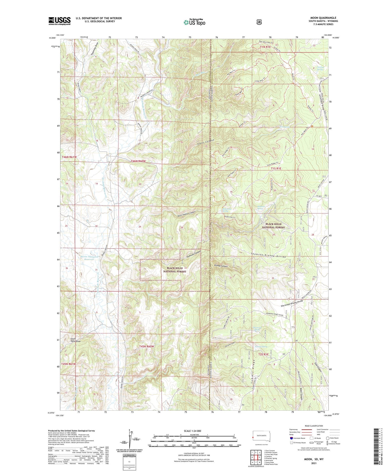
2021 topographic map quadrangle Moon in the states of Wyoming, South Dakota. Scale: 1:24000. Based on the newly updated USGS 7.5' US Topo map series, this map is in the following counties: Pennington, Weston. The map contains contour data, water features, and other items you are used to seeing on USGS maps, but also has updated roads and other features. This is the next generation of topographic maps. Printed on high-quality waterproof paper with UV fade-resistant inks.
Quads adjacent to this one:
West: Cambria
Northwest: Four Corners
North: Parmlee Canyon
Northeast: Crows Nest Peak
East: Preacher Spring
Southeast: Dead Horse Flats
South: Fanny Peak
Southwest: Newcastle
Contains the following named places: Antelope Springs, Bear Run, Brown Canyon, Dolores Number 1 Dam, Jordon Dam, Jordon Reservoir, Kinney Canyon, Last Chance Filler Pit Mine, Little Bear Run, Martin Thompson Dam, Martin Thompson Reservoir, Moon, Moon Campground, Neuman-Scott Ranch, North Thomson Canyon, Rudenvale Spring, Sherwood Canyon, Sherwood Spring, Sherwood-Kinney Divide, Stots Canyon, Stots Spring, Summit Ridge, Summit Spring, Thoeming Draw, Thomson Canyon, Thomson Spring, Thomson-Kinney Divide


