MyTopo
Four Corners Wyoming US Topo Map
Couldn't load pickup availability
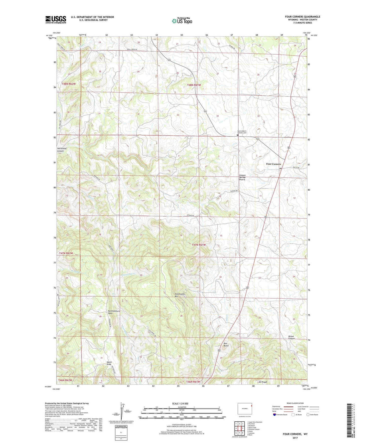
2021 topographic map quadrangle Four Corners in the state of Wyoming. Scale: 1:24000. Based on the newly updated USGS 7.5' US Topo map series, this map is in the following counties: Weston. The map contains contour data, water features, and other items you are used to seeing on USGS maps, but also has updated roads and other features. This is the next generation of topographic maps. Printed on high-quality waterproof paper with UV fade-resistant inks.
Quads adjacent to this one:
West: Skull Creek
Northwest: Inyan Kara Mountain
North: Dry Draw
Northeast: Buckhorn
East: Parmlee Canyon
Southeast: Moon
South: Cambria
Southwest: Pedro
This map covers the same area as the classic USGS quad with code o44104a2.
Contains the following named places: Canyon Springs Prairie, Elliot Mine, Four Corners, Four Corners Post Office, Horsethief Canyon, Miller Quarry Mine, Northwestern Table, Red Butte, Roundhouse Mine, Saint Albert Church, Saint Albert's Catholic Cemetery, State Land Quarry Mine, Sweetwater Mountain, ZIP Code: 82715