MyTopo
Nisland South Dakota US Topo Map
Couldn't load pickup availability
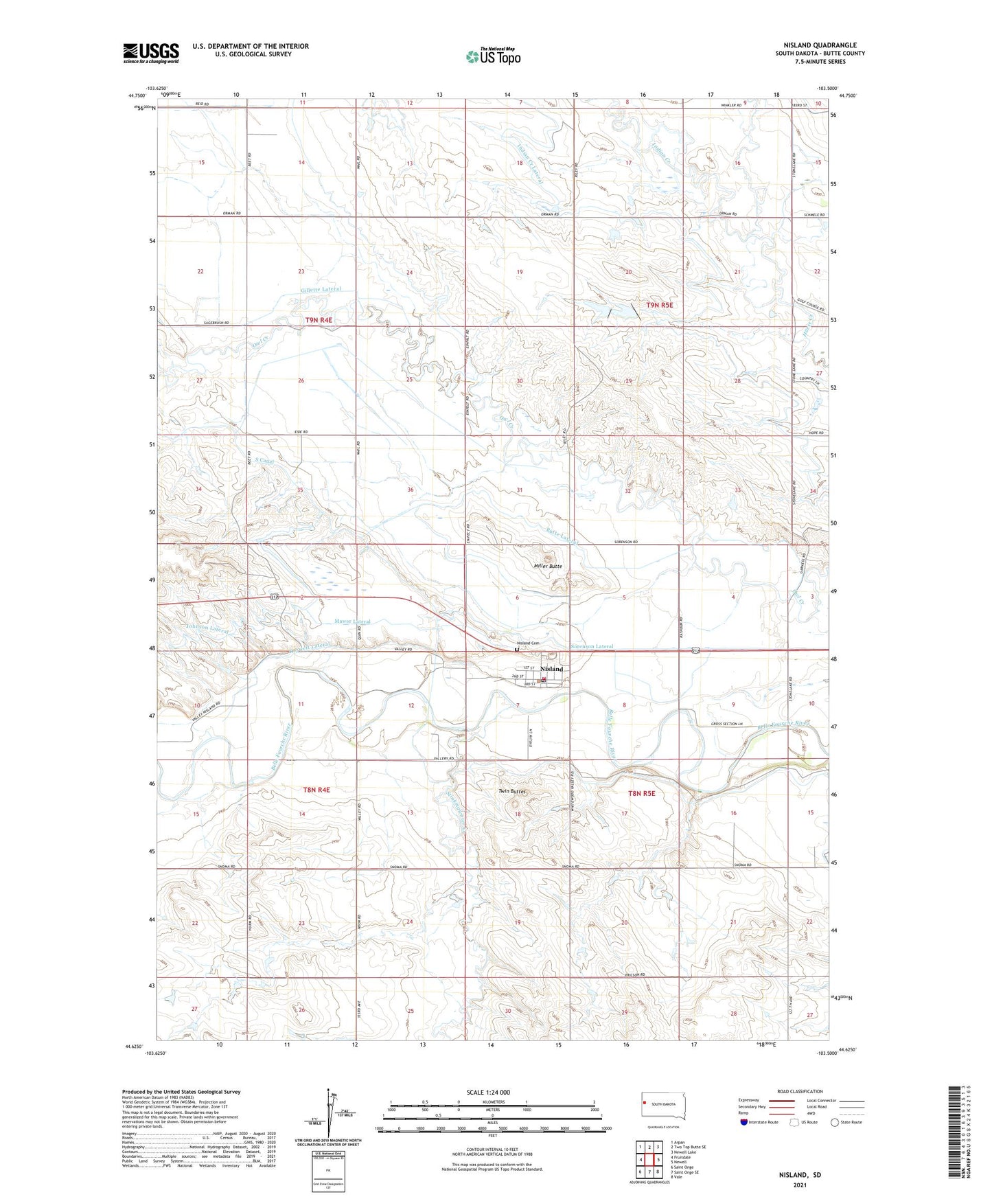
2021 topographic map quadrangle Nisland in the state of South Dakota. Scale: 1:24000. Based on the newly updated USGS 7.5' US Topo map series, this map is in the following counties: Butte. The map contains contour data, water features, and other items you are used to seeing on USGS maps, but also has updated roads and other features. This is the next generation of topographic maps. Printed on high-quality waterproof paper with UV fade-resistant inks.
Quads adjacent to this one:
West: Fruitdale
Northwest: Arpan
North: Two Top Butte SE
Northeast: Newell Lake
East: Newell
Southeast: Vale
South: Saint Onge SE
Southwest: Saint Onge
This map covers the same area as the classic USGS quad with code o44103f5.
Contains the following named places: Butte Lateral, Chase School, Gillette Lateral, Hillside School, Horse Creek School, Indian Creek, Korwelt Lateral, Mawer Lateral, Miller Butte, Nisland, Nisland Cemetery, Nisland City Hall, Nisland Post Office, Nisland Volunteer Fire Department, Sorenson Lateral, Stinkingwater Creek, Town of Nisland, Twin Buttes