MyTopo
Norbeck South Dakota US Topo Map
Couldn't load pickup availability
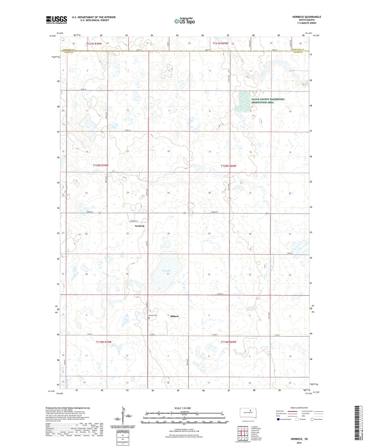
2021 topographic map quadrangle Norbeck in the state of South Dakota. Scale: 1:24000. Based on the newly updated USGS 7.5' US Topo map series, this map is in the following counties: Faulk, Edmunds. The map contains contour data, water features, and other items you are used to seeing on USGS maps, but also has updated roads and other features. This is the next generation of topographic maps. Printed on high-quality waterproof paper with UV fade-resistant inks.
Quads adjacent to this one:
West: Clark Lake
Northwest: Loyalton
North: Stafford Dam
Northeast: Ipswich SE
East: Wecota
Southeast: Faulkton East
South: Faulkton West
Southwest: Burkmere
This map covers the same area as the classic USGS quad with code o45099b2.
Contains the following named places: Blumengard Colony, Blumengard Colony Census Designated Place, Blumengard Colony Elementary School, Dry Lake, Hamak Dam, Hamak Lake, Hammok Lake, Millard, Millard Cemetery, Millard School, Norbeck, Orleans, Orleans School, South Dakota State University Pasture Research Center, Township of Freedom