MyTopo
Faulkton East South Dakota US Topo Map
Couldn't load pickup availability
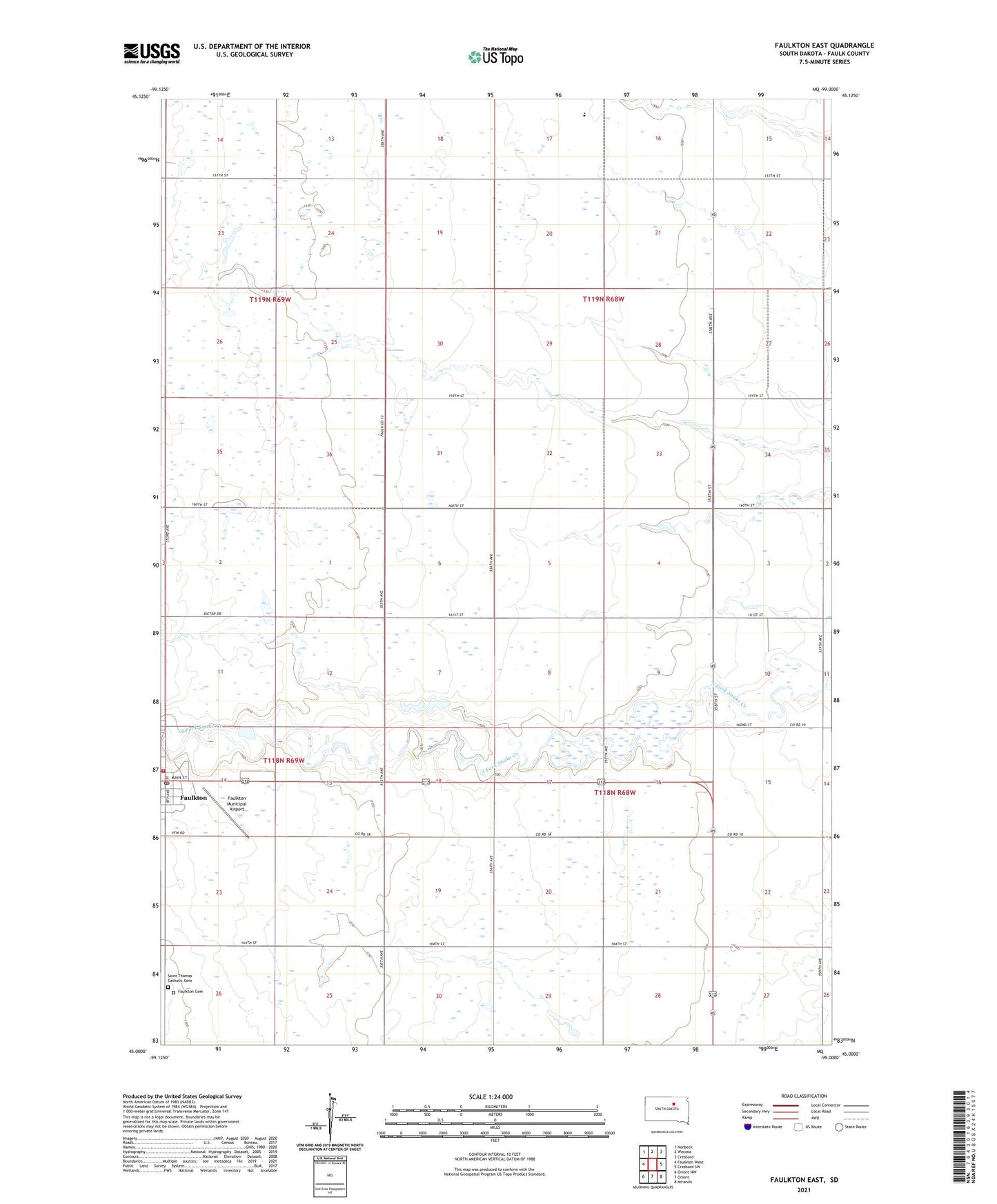
2021 topographic map quadrangle Faulkton East in the state of South Dakota. Scale: 1:24000. Based on the newly updated USGS 7.5' US Topo map series, this map is in the following counties: Faulk. The map contains contour data, water features, and other items you are used to seeing on USGS maps, but also has updated roads and other features. This is the next generation of topographic maps. Printed on high-quality waterproof paper with UV fade-resistant inks.
Quads adjacent to this one:
West: Faulkton West
Northwest: Norbeck
North: Wecota
Northeast: Cresbard
East: Cresbard SW
Southeast: Miranda
South: Orient
Southwest: Orient NW
This map covers the same area as the classic USGS quad with code o45099a1.
Contains the following named places: Evergreen Colony, Evergreen Colony Census Designated Place, Evergreen Colony Elementary School, Faulk County Ambulance Service, Faulkton, Faulkton Cemetery, Faulkton City Hall, Faulkton Fire Department, Faulkton Municipal Airport, Faulkton Post Office, LaFoon, LaFoon School, Melius School, Reed School, Saint Thomas Catholic Cemetery, Township of Lafoon, Township of Myron