MyTopo
Faulkton West South Dakota US Topo Map
Couldn't load pickup availability
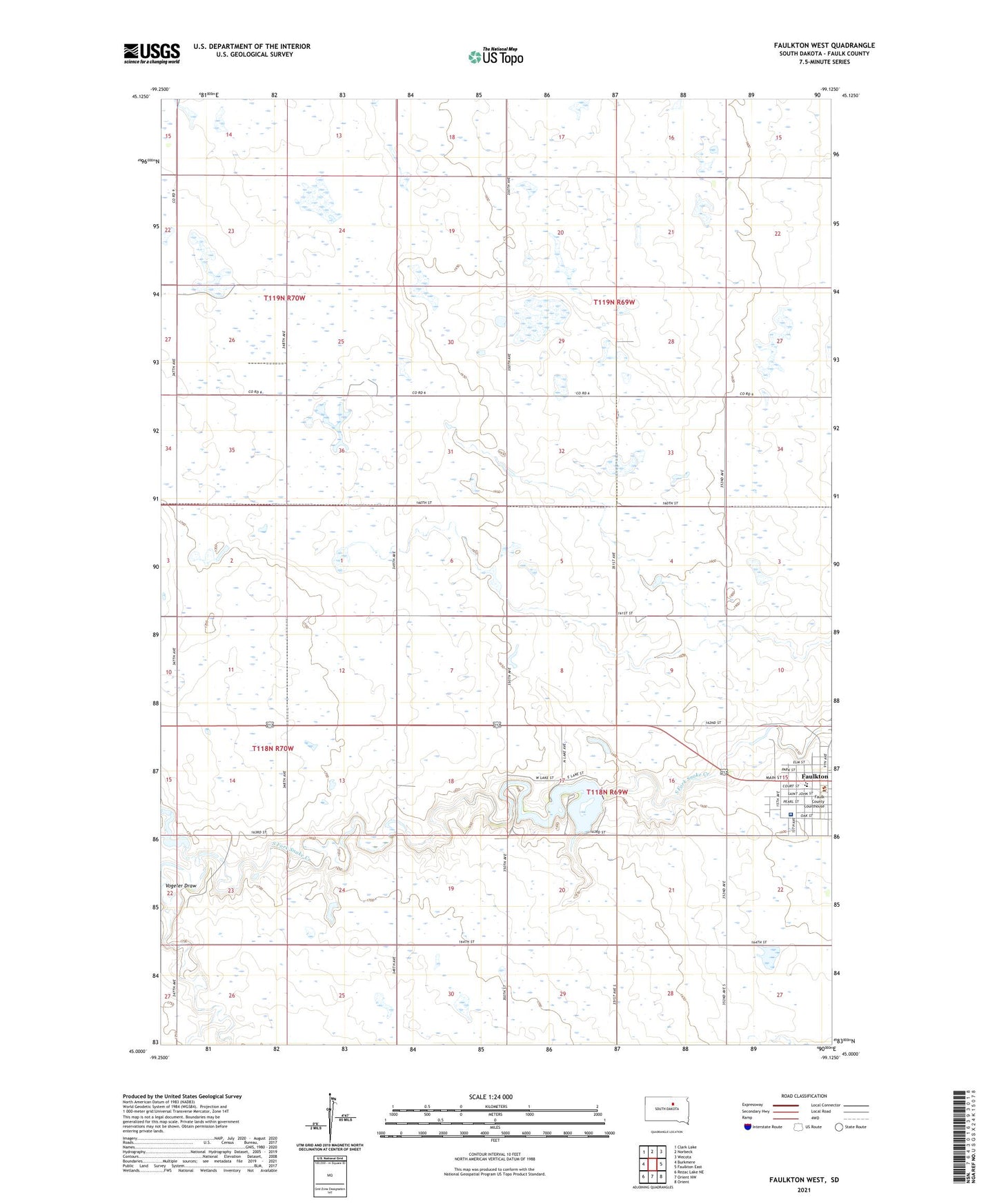
2021 topographic map quadrangle Faulkton West in the state of South Dakota. Scale: 1:24000. Based on the newly updated USGS 7.5' US Topo map series, this map is in the following counties: Faulk. The map contains contour data, water features, and other items you are used to seeing on USGS maps, but also has updated roads and other features. This is the next generation of topographic maps. Printed on high-quality waterproof paper with UV fade-resistant inks.
Quads adjacent to this one:
West: Burkmere
Northwest: Clark Lake
North: Norbeck
Northeast: Wecota
East: Faulkton East
Southeast: Orient
South: Orient NW
Southwest: Rezac Lake NE
This map covers the same area as the classic USGS quad with code o45099a2.
Contains the following named places: Baldwin School, City of Faulkton, Faulk County, Faulk County Courthouse, Faulk County Jail, Faulk County Library, Faulk County Sheriff, Faulkton Area Medical Center, Faulkton Dam, Faulkton Elementary School, Faulkton High School, Faulkton Junior High School, Lake Faulkton, Lake Fualkton State Game Refuge, Tamworth School, Township of Faulkton, Township of Pulaski, Township of Tamworth, Unorganized Territory of Pulaski, Vogeler Draw, Walgamuth School, ZIP Code: 57438