MyTopo
Okobojo SW South Dakota US Topo Map
Couldn't load pickup availability
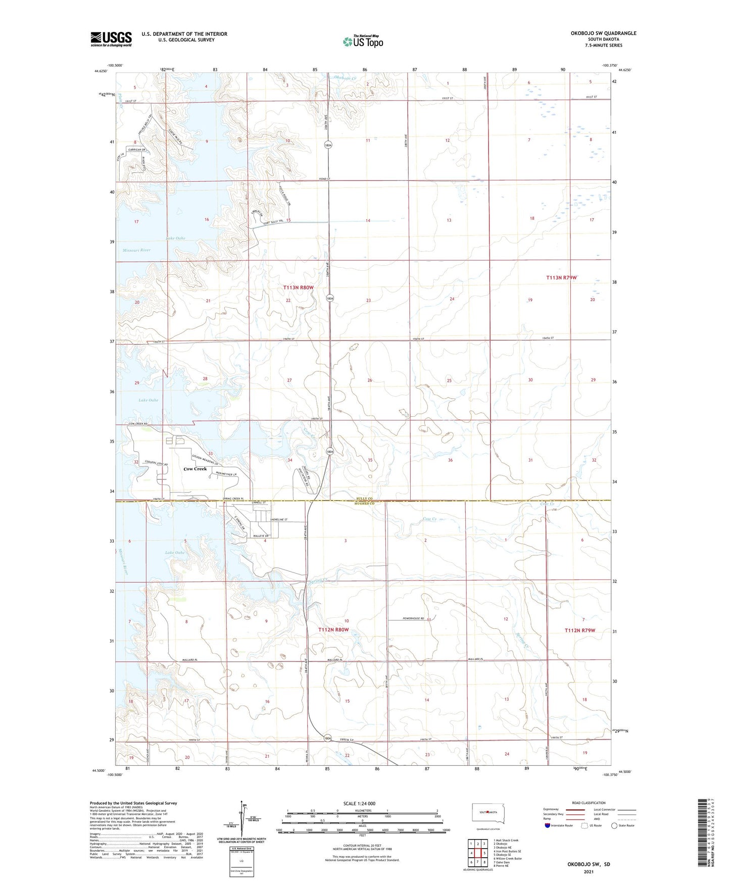
2021 topographic map quadrangle Okobojo SW in the state of South Dakota. Scale: 1:24000. Based on the newly updated USGS 7.5' US Topo map series, this map is in the following counties: Sully, Hughes. The map contains contour data, water features, and other items you are used to seeing on USGS maps, but also has updated roads and other features. This is the next generation of topographic maps. Printed on high-quality waterproof paper with UV fade-resistant inks.
Quads adjacent to this one:
West: Iron Post Buttes SE
Northwest: Mail Shack Creek
North: Okobojo
Northeast: Okobojo NE
East: Okobojo SE
Southeast: Pierre NE
South: Oahe Dam
Southwest: Willow Creek Butte
This map covers the same area as the classic USGS quad with code o44100e4.
Contains the following named places: Al Reddin Dam, Cow Creek, Cow Creek Census Designated Place, Cow Creek Recreation Area, Koskan Dam, Okobojo Creek Recreation Area, Plainview School, Spring Creek, Spring Creek Recreation Area, Taylor Brothers Dam