MyTopo
Orient South Dakota US Topo Map
Couldn't load pickup availability
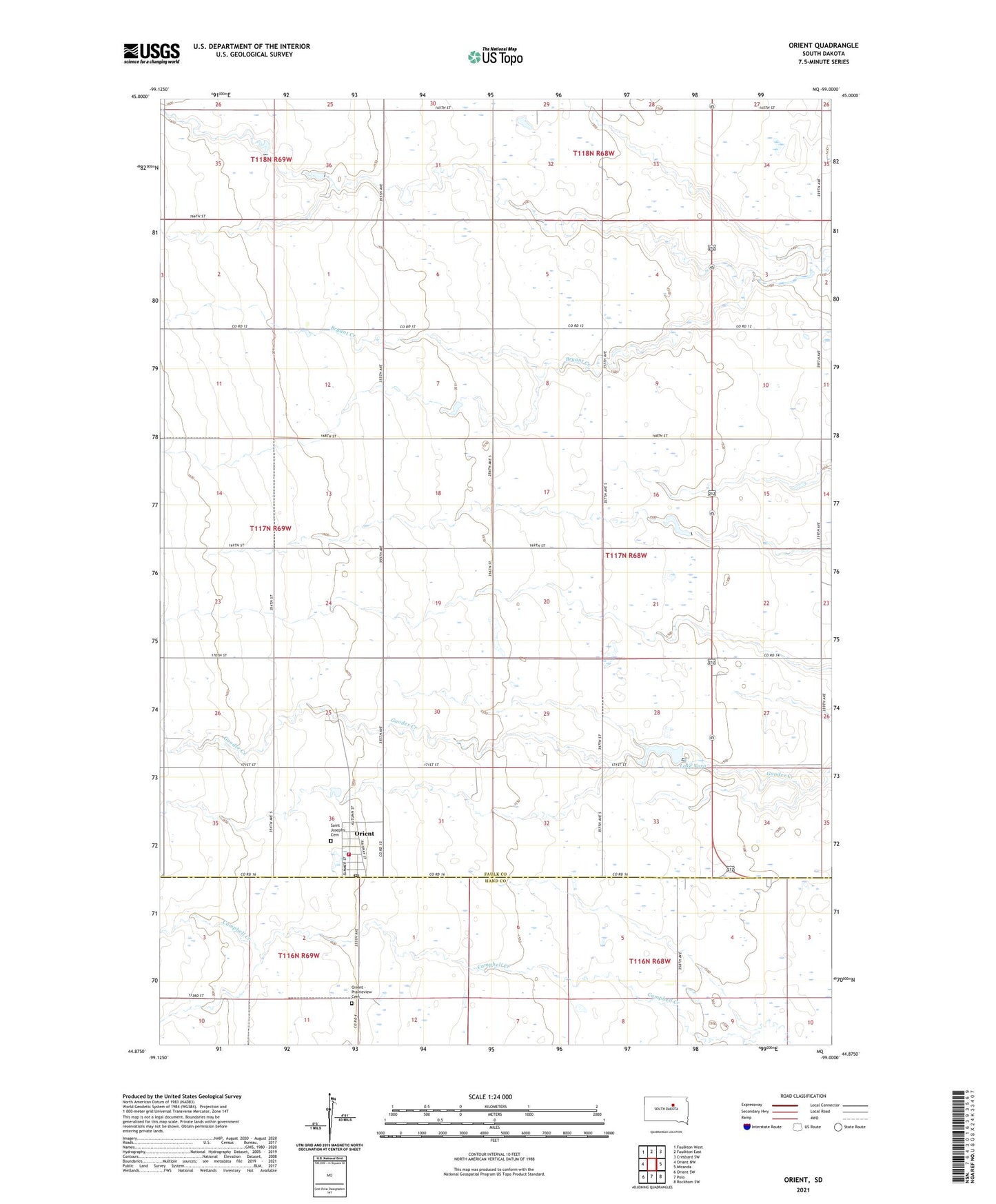
2021 topographic map quadrangle Orient in the state of South Dakota. Scale: 1:24000. Based on the newly updated USGS 7.5' US Topo map series, this map is in the following counties: Faulk, Hand. The map contains contour data, water features, and other items you are used to seeing on USGS maps, but also has updated roads and other features. This is the next generation of topographic maps. Printed on high-quality waterproof paper with UV fade-resistant inks.
Quads adjacent to this one:
West: Orient NW
Northwest: Faulkton West
North: Faulkton East
Northeast: Cresbard SW
East: Miranda
Southeast: Rockham SW
South: Polo
Southwest: Orient SW
This map covers the same area as the classic USGS quad with code o44099h1.
Contains the following named places: Davis School, Gaffney School, Lake Nora, Orient, Orient - Prairieview Cemetery, Orient Fire Department, Orient Post Office, Ree Valley, Ross School, Saint Josephs Cemetery, Selting School, Town of Orient, Township of Arcade