MyTopo
Peever NE South Dakota US Topo Map
Couldn't load pickup availability
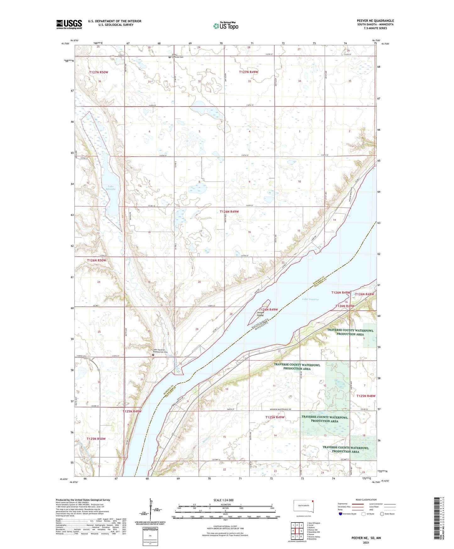
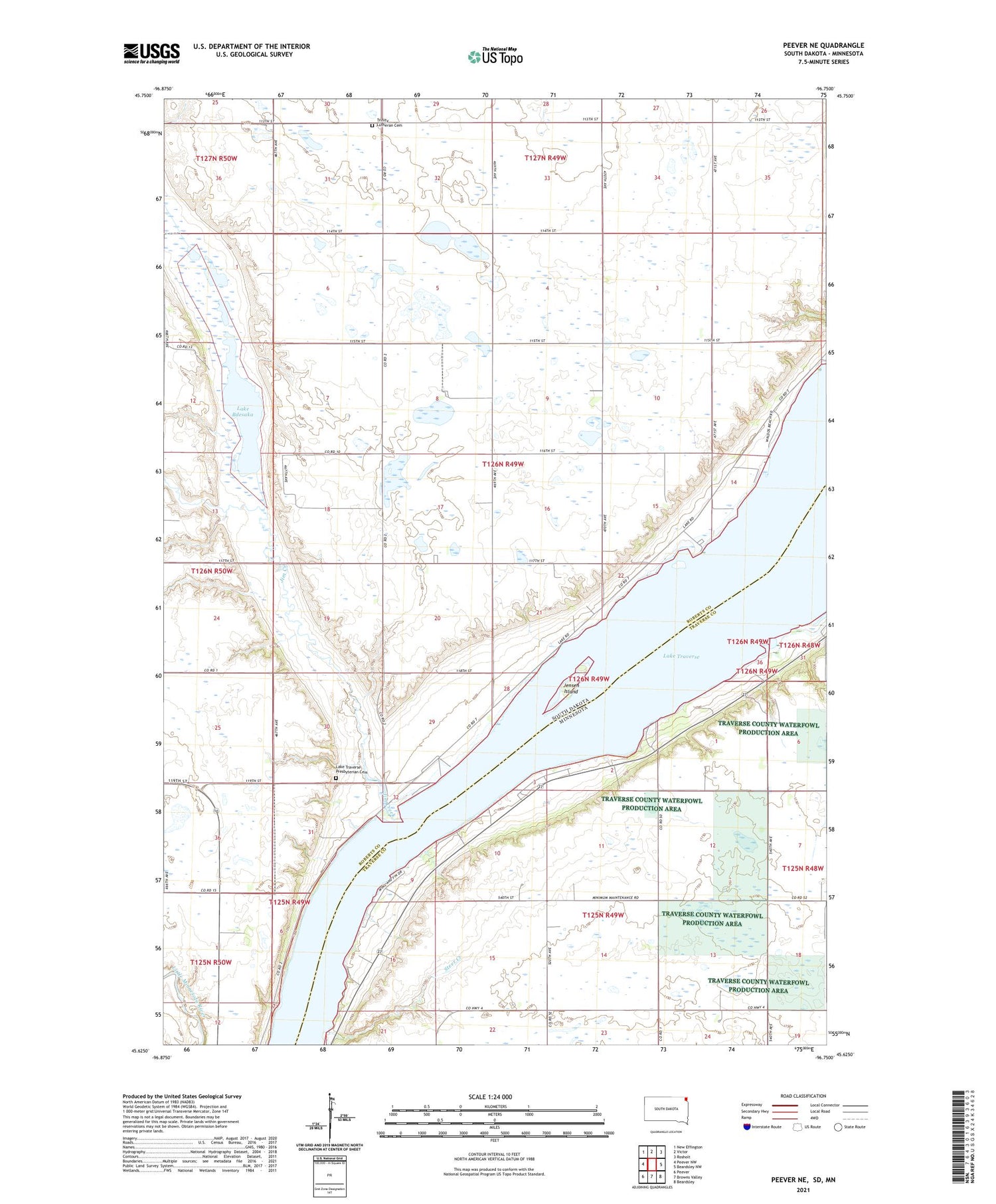
2021 topographic map quadrangle Peever NE in the states of South Dakota, Minnesota. Scale: 1:24000. Based on the newly updated USGS 7.5' US Topo map series, this map is in the following counties: Roberts, Traverse. The map contains contour data, water features, and other items you are used to seeing on USGS maps, but also has updated roads and other features. This is the next generation of topographic maps. Printed on high-quality waterproof paper with UV fade-resistant inks.
Quads adjacent to this one:
West: Peever NW
Northwest: New Effington
North: Victor
Northeast: Rosholt
East: Beardsley NW
Southeast: Beardsley
Southwest: Peever
Contains the following named places: Circle K Resort, Cottonwood Slough, Indian Baptist Church, Jensen Island, Jim Creek, K-and-K Resort, Lake Bdesaka, Lake Traverse Presbyterian Cemetery, Lake Traverse Presbyterian Church, Old Indian Church, Pheasant Ridge Resort, Rock Island Resort, School Number 1, School Number 2, Steer Creek, Tinity Church, Township of Bryant, Township of Folsom, Trinity Lutheran Cemetery, Windom