
MyTopo
Savoy South Dakota US Topo Map
Couldn't load pickup availability
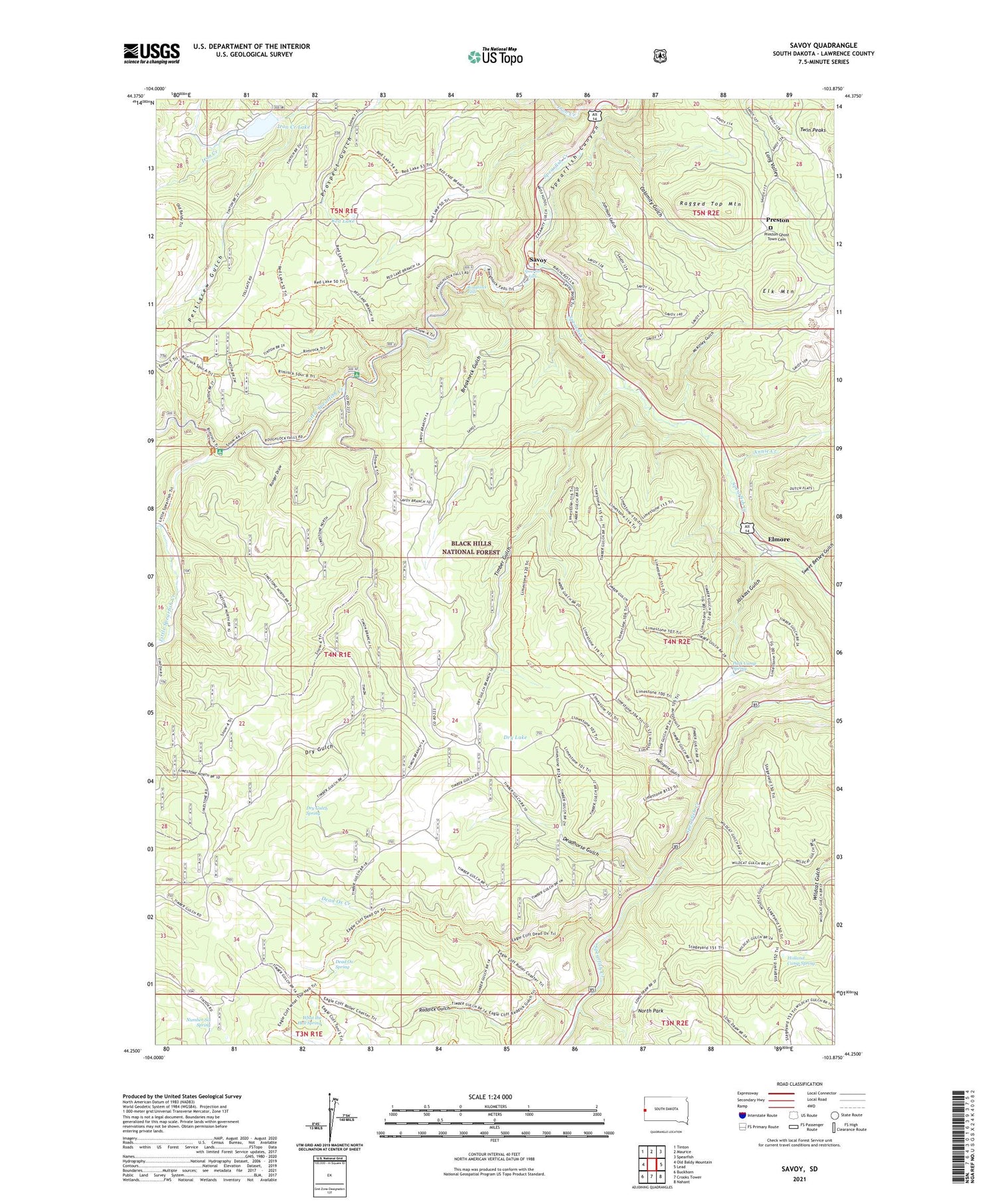
2021 topographic map quadrangle Savoy in the state of South Dakota. Scale: 1:24000. Based on the newly updated USGS 7.5' US Topo map series, this map is in the following counties: Lawrence. The map contains contour data, water features, and other items you are used to seeing on USGS maps, but also has updated roads and other features. This is the next generation of topographic maps. Printed on high-quality waterproof paper with UV fade-resistant inks.
Quads adjacent to this one:
West: Old Baldy Mountain
Northwest: Tinton
North: Maurice
Northeast: Spearfish
East: Lead
Southeast: Nahant
South: Crooks Tower
Southwest: Buckhorn
Contains the following named places: Anchor II, Annie Creek, Balmoral, Breakneck Gulch, Calamity Gulch, Dacy, Dead Ox Creek, Dead Ox Spring, Deadhorse Gulch, Dry Gulch, Dry Gulch Spring, Dry Lake, Elk Mountain, Elmore, Eva H and Silver Tongue Mine, Hellsgate Gulch, Holland Camp Spring, Iron Creek, Iron Creek Dam, Iron Creek Lake, Iron Creek Trail, Jackass Gulch, Johnson Gulch, Limestone Plateau, Little Spearfish Creek, Little Spearfish Guard Station, Lost Camp, McKinley Gulch, Metallic Streak Mine, Nerve City, North Park, Number Six Spring, Park Camp Spring, Pettigrew Gulch, Preston, Preston Ghost Town Cemetery, Raddick Gulch, Ragged Top, Ragged Top Mountain, Ranger Draw, Red Lake, Rim Rock Trail, Rod and Gun Campground, Roughlock Falls, Roughlock Falls Picnic Area, Savoy, Sheep Flats, Spearfish Canyon Fire Protection District, Spearfish Falls, Sweet Betsey Gulch, Timber Gulch, Timon Campground, Twin Peaks, Ulster Mine, What the Hell Spring, ZIP Code: 57754


