MyTopo
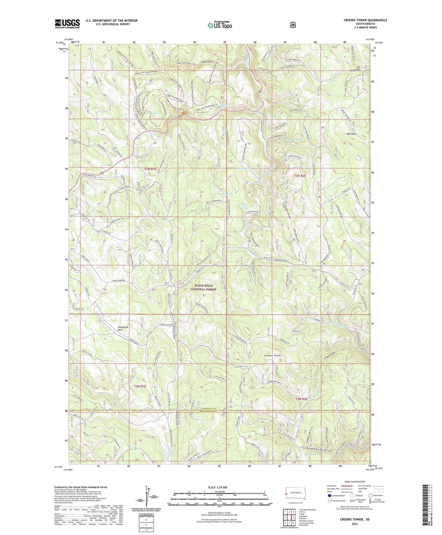
Crooks Tower South Dakota US Topo Map
Couldn't load pickup availability
Also explore the Crooks Tower Forest Service Topo of this same quad for updated USFS data
2021 topographic map quadrangle Crooks Tower in the state of South Dakota. Scale: 1:24000. Based on the newly updated USGS 7.5' US Topo map series, this map is in the following counties: Lawrence, Pennington. The map contains contour data, water features, and other items you are used to seeing on USGS maps, but also has updated roads and other features. This is the next generation of topographic maps. Printed on high-quality waterproof paper with UV fade-resistant inks.
Quads adjacent to this one:
West: Buckhorn
Northwest: Old Baldy Mountain
North: Savoy
Northeast: Lead
East: Nahant
Southeast: Deerfield
South: Crows Nest Peak
Southwest: Parmlee Canyon
This map covers the same area as the classic USGS quad with code o44103b8.
Contains the following named places: Bombard Draw, Clayton Draw, Clayton Pond, Clayton Willow Exclosure, Crooks Lake, Crooks Tower, Deadman Spring, Dry Lake Pond, Gustave, Intake Gulch, Lander Spring, Macs Camp, McInerny Ranch, McQuaig, Merow Spring, Mix Spring, Potato Spring, Stovehole Park, Tepee, Trebor Draw, Well Park, Yellow Jacket Spring