MyTopo
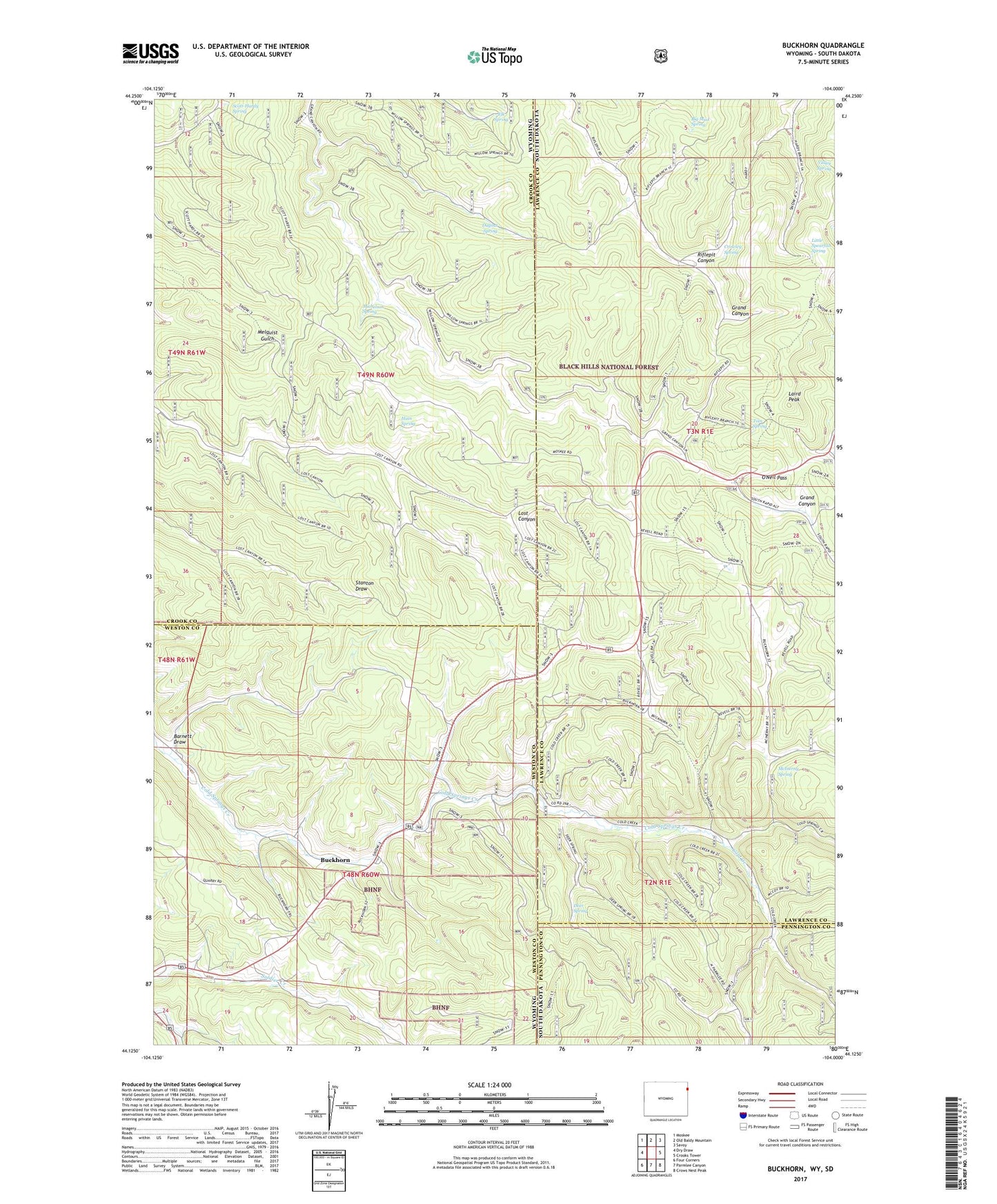
Buckhorn Wyoming US Topo Map
Couldn't load pickup availability
Also explore the Buckhorn Forest Service Topo of this same quad for updated USFS data
2021 topographic map quadrangle Buckhorn in the states of Wyoming, South Dakota. Scale: 1:24000. Based on the newly updated USGS 7.5' US Topo map series, this map is in the following counties: Weston, Lawrence, Crook, Pennington. The map contains contour data, water features, and other items you are used to seeing on USGS maps, but also has updated roads and other features. This is the next generation of topographic maps. Printed on high-quality waterproof paper with UV fade-resistant inks.
Quads adjacent to this one:
West: Dry Draw
Northwest: Moskee
North: Old Baldy Mountain
Northeast: Savoy
East: Crooks Tower
Southeast: Crows Nest Peak
South: Parmlee Canyon
Southwest: Four Corners
This map covers the same area as the classic USGS quad with code o44104b1.
Contains the following named places: Barnett Draw, Big Mud Spring, Buckhorn, Cold Creek, Crowley Spring, Deer Spring, Dugout Spring, Elk Spring, Hain Spring, Hardy Guard Station, Laird Peak, Little Spearfish Spring, McInerny Spring, Michelson Spring, O'Neil Pass, O'Neil School, Rawhauser Quarry Mine, Scott-Hardy Spring, Tom Spring, Valley Spring