MyTopo
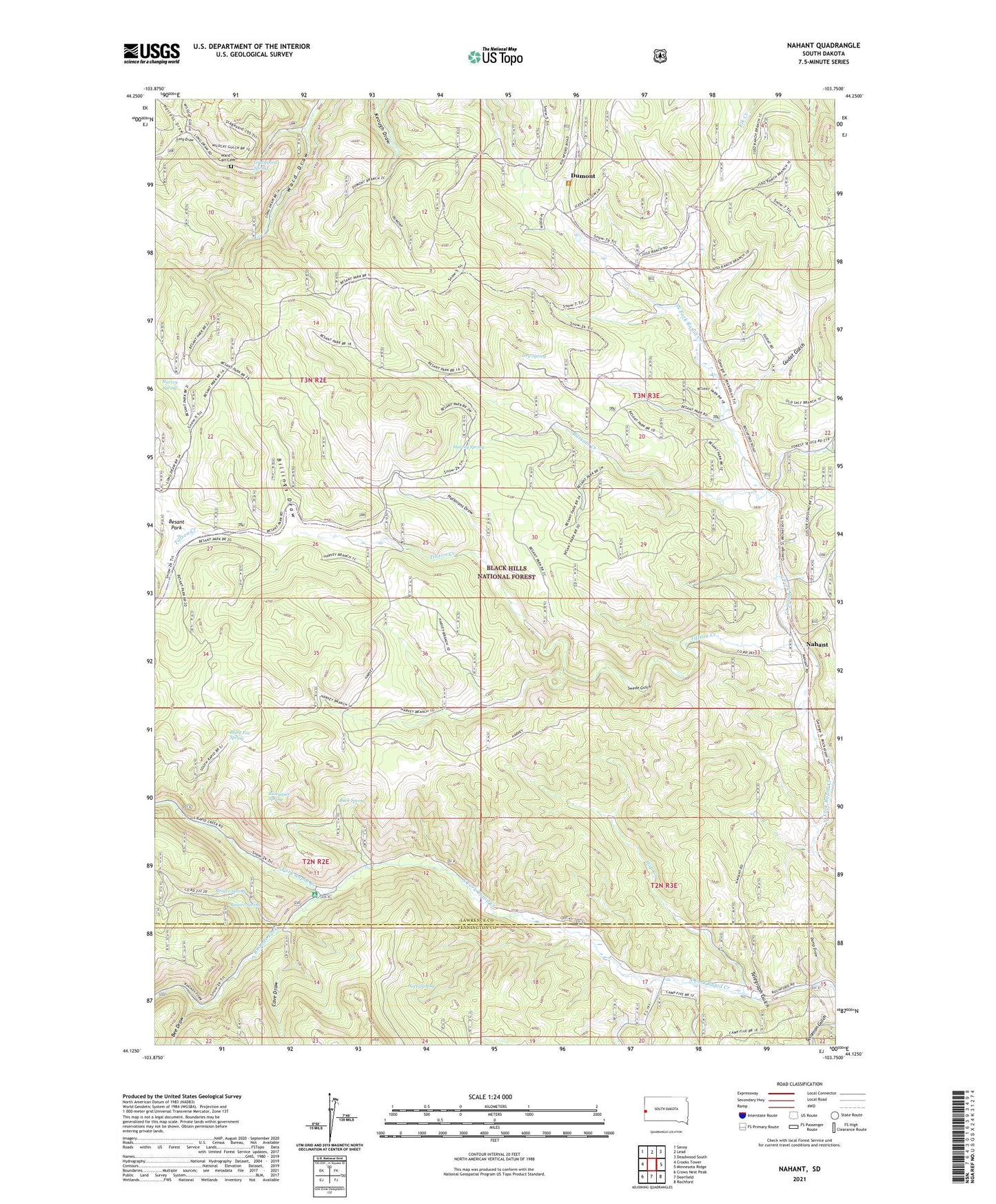
Nahant South Dakota US Topo Map
Couldn't load pickup availability
Also explore the Nahant Forest Service Topo of this same quad for updated USFS data
2021 topographic map quadrangle Nahant in the state of South Dakota. Scale: 1:24000. Based on the newly updated USGS 7.5' US Topo map series, this map is in the following counties: Lawrence, Pennington. The map contains contour data, water features, and other items you are used to seeing on USGS maps, but also has updated roads and other features. This is the next generation of topographic maps. Printed on high-quality waterproof paper with UV fade-resistant inks.
Quads adjacent to this one:
West: Crooks Tower
Northwest: Savoy
North: Lead
Northeast: Deadwood South
East: Minnesota Ridge
Southeast: Rochford
South: Deerfield
Southwest: Crows Nest Peak
This map covers the same area as the classic USGS quad with code o44103b7.
Contains the following named places: Beaver Spring, Bee Draw, Besant Park, Billings Draw, Black Fox, Black Fox Campground, Black Fox Spring, Black Fox Summer Homes, Buck Spring, Bull Dog Ranch, Bulldog, Buskala Creek, Buskala Ranch, Cave Draw, Cave Draw Summer Homes, Dumont, Dumont School, Dump Draw, Elkhorn I, Florence, French Ranch, Graveyard Spring, Gudat Gulch, Gudat Ranch, Hallorans Draw, Harvey Ranch, Harvey Spring, Hausle Ranch, Hollens Draw, Hop Creek, Irey Spring, Juso Ranch, Long Draw, McKay Summer Homes, Melcher Ranch, Nahant, Nahant School, North Rapid Stage Station, Peterson Ranch, Rhoads Fork, Rickgauer Spring, Sasse Ranch, Seep Spring, Swede Gulch, Telegraph Gulch, Texana, Tillson Creek, Unorganized Territory of South Lawrence, Ward - Carr Cemetery