
MyTopo
Soldier Creek NE South Dakota US Topo Map
Couldn't load pickup availability
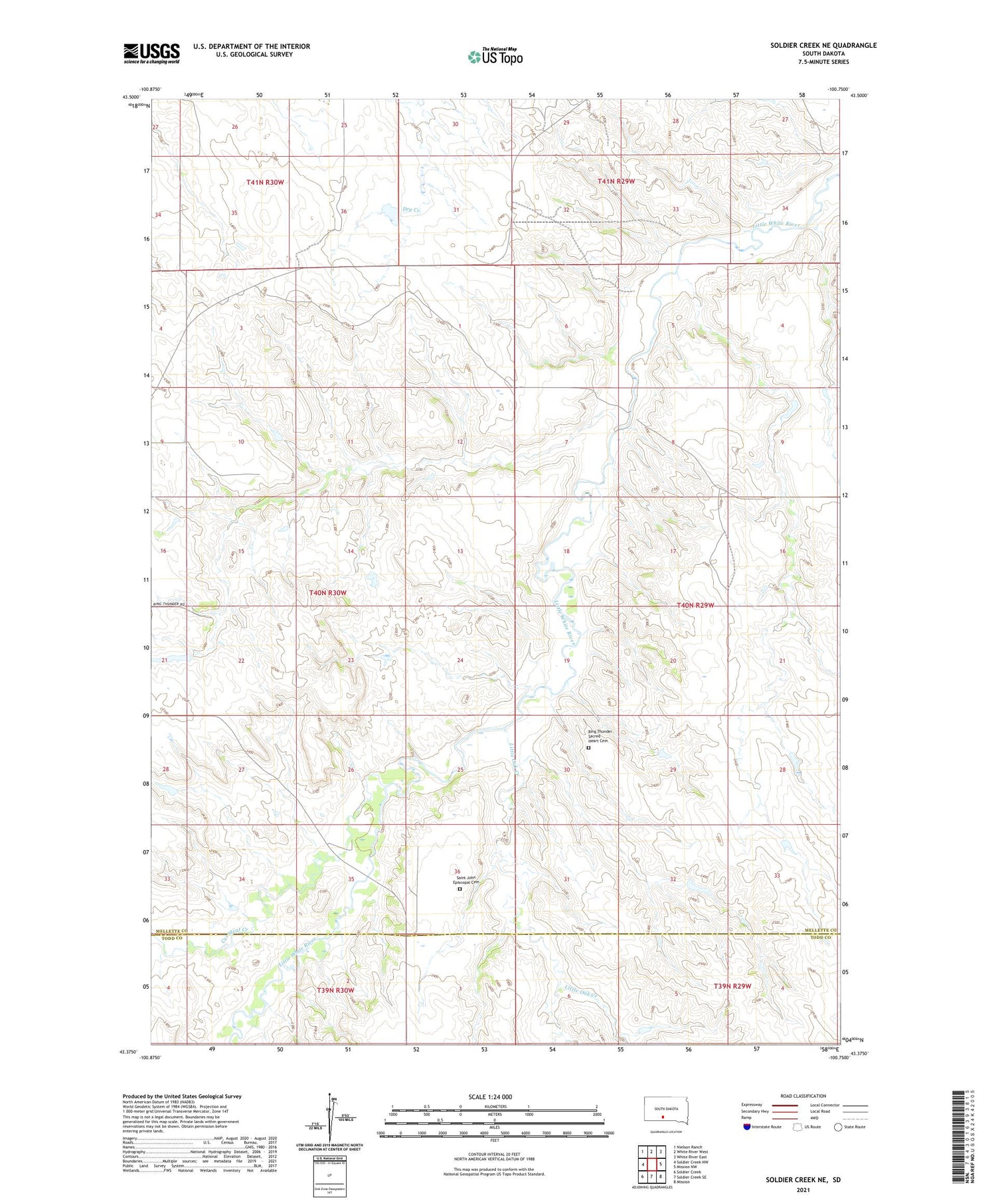
2021 topographic map quadrangle Soldier Creek NE in the state of South Dakota. Scale: 1:24000. Based on the newly updated USGS 7.5' US Topo map series, this map is in the following counties: Mellette, Todd. The map contains contour data, water features, and other items you are used to seeing on USGS maps, but also has updated roads and other features. This is the next generation of topographic maps. Printed on high-quality waterproof paper with UV fade-resistant inks.
Quads adjacent to this one:
West: Soldier Creek NW
Northwest: Nielson Ranch
North: White River West
Northeast: White River East
East: Mission NW
Southeast: Mission
South: Soldier Creek SE
Southwest: Soldier Creek
Contains the following named places: Adrian Number 2 Dam, Cut Meat Creek, Horse Creek Segment, Krogman Harold Number 1 Dam, Krogman Harold Number 3 Dam, Krogman Louie Number 1 Dam, Krogman Louie Number 2 Dam, Krogman Number 6 Dam, Krooman Number 1 Dam, Little Oak Creek, Ring Thunder Sacred Heart Cemetery, Saint John Episcopal Cemetery, Township of Ring Thunder


